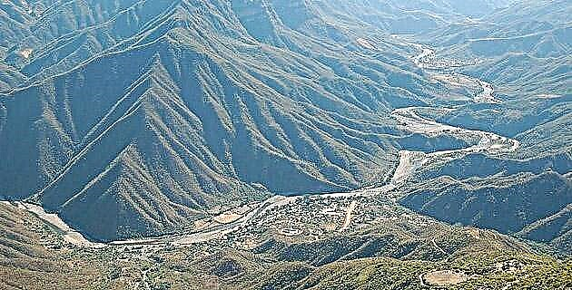
In mid-2000, the southeastern border highway was inaugurated in Chiapas, parallel to and very close to the Mexico-Guatemala border. It begins in Palenque and ends in the Montebello lakes; they are 422 km, most of it through the Lacandon Jungle.
After the first 50 km, the road runs near the Usumacinta River, up to that remote corner of the Mexican Republic which is the Marqués de Comillas area. It travels 250 km towards the southeast and reaches the apex in the town of Flor de Cacao, where it turns west and ascends to Montebello; the new road surrounds the Montes Azules Biosphere Reserve.
The initial 50 km of the journey are winding and the last 50 much more. The intermediate part is mostly made up of endless lines. Due to the numerous checkpoints, from the Secretary of the Navy at the beginning (in the vicinity of the Usumacinta River) and the Mexican Army later, the route is very safe. Regarding fuel, there are petrol stations and rustic outlets in various towns. But let's go in parts.
Palenque, for many years, has had good land communications. 8 km from there, along the road that goes to Agua Azul and Ocosingo, the border route starts on the left. At km 122 you will find the San Javier ranchería, where you turn right and 4 km you will find a "Y": to the right, 5 km away is the main Lacandón town, Lacanjá, and to the left the archaeological zone Bonampak, 10 km of acceptable dirt road. Its murals are well preserved because the restoration work on them and the ruins is first class. But let's go back to Lacanjá.
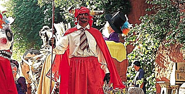
127 Lacandon families live in that small village. The master craftsman Bor García Paniagua is very happy to receive strangers and sell them his pieces of popular art: jaguars carved in wood, clay dolls dressed in vegetable fiber clothes called majahua and various necklaces made with tropical seeds from the area, among others .
By the way, adult Lacandons give themselves the name that they like the most, regardless of what their parents have given them, so there are several homonyms of presidents of Mexico and this artist with the surnames of a Chiapas governor. In Lacanjá we hired a young guide named Kin (Sol) Chancayún (little bee), who took us to La Cascada, a paradisiac place 4 km on foot along a path that crosses the closed jungle, almost dark due to the 3 “Floors” of vegetation that hang over our heads; we crossed eleven streams by rustic log bridges. The waterfall has 3 waterfalls, the largest of about 15 m high and is formed by the Cedro river; endowed with beautiful pools for swimming. Due to the hydrological phenomenon itself and the fantastic jungle route between lianas and arboreal colossi (approximately one hour and another hour back), it is worth visiting!
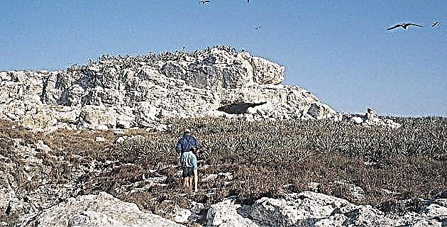
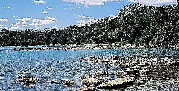
Let's continue along the border highway. Towards km 120 we will find the Natural Reserve of the Sierra de la Cojolita. We continue until km 137 and take a 17 km branch to the left that takes us to the town of Frontera Corozal, on the banks of the Usumacinta River, in front of Guatemala; there is the excellent ecotourism ejidal hotel Escudo Jaguar, with small bungalows that preserve the wisdom of vernacular architecture. Right there we hired a long, narrow motor canoe to sail 45 minutes downstream to the fabulous Yaxchilán, the lost city of the Mayans, where we arrived shortly after dawn in the mist that floated over the river.
We had to hear some terrifying and deep roars, which made us feel in the middle of an attack of wild cats; It turned out to be a herd of saraguatos, which roar felinely and move through the highest of the giant treetops. We also saw a group of playful spider monkeys, a flock of multi-colored macaws, a couple of toucans, and countless other birds and insects of all sizes. By the way, in Simojovel we tried the tzatz, rubber tree worms fried and seasoned with salt, lemon and dried and ground chili.
The return to Frontera Corozal took an hour to sail against the current. From this same town it is possible to hire the boat to arrive in half an hour to Bethel, a coastal town on the Guatemalan side.
We continue along the road and at km 177 we cross the Lacantún River; At km 185 the town Benemérito de las Américas is located and then there are other rivers: the Chajul at km 299 and the Ixcán towards 315.
In the latter you can navigate 30 minutes to get to Ixcán Station, an ecotourism center with lodging, food, camping areas, excursions through various trails in the jungle, flora and fauna observation posts, night tours along the Jataté River, descent by rapids, temazcal, orchid and much more.
Crossing the highway there are more rivers: Santo Domingo at km 358, Dolores at 366 and shortly after is the town of Nuevo Huixtán, where they grow annatto. At km 372 it crosses the Pacayal river. Ahead is Nuevo San Juan Chamula, municipality of Las Margaritas, where delicious pineapples similar to Hawaiians are grown.
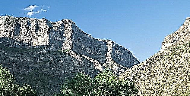
Here the road has already become a frank ascent, winding, with spectacular views of the ravines, whose fertile vegetation is transforming from the jungle to the semi-tropical. Exotic flowers called “birds of paradise” abound, growing wild here. Bromeliads and orchids abound.
The last significant river is the Santa Elena at km 380. Later, as we approach 422, various lakes begin to be seen to the right and left with the full range of blue colors: we arrived at Montebello!