For nature lovers who enjoy a long walk through different environments, the journey to the Cotlamanis Plateau will provide great satisfaction.
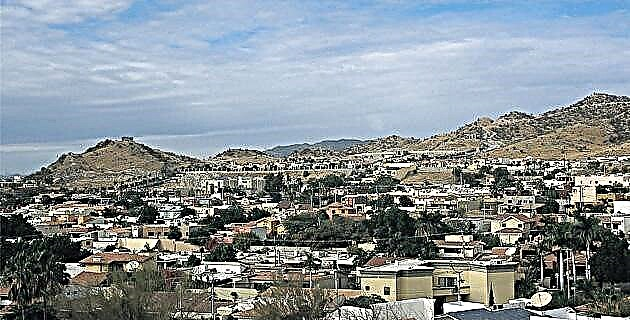
We start the journey in Jalcomulco, Veracruz, a town located about 42 km from Xalapa, with about 2,600 inhabitants.
Eager to make the most of the new day, we woke up as the night was almost over. A nutritious breakfast was necessary to cope with the multi-hour walk. Thanks to the resistance of the donkeys that carried our packages, we were able to lighten up, and with only the canteen and the camera on our backs, we started our way to Cotlamanis.
We crossed through a mangal; from various points you have a complete panorama of Jacomulco and the Pescados River delimiting it.
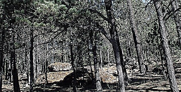
The Buena Vista plateau, the first inhabited area we found, houses a tiny town; navigating it is a matter of a few steps. The path led us to the canyon and when observing the landscape I felt that the view was deceiving me: deep ravines with a river in the background mixed and intertwined with steep hills. The overflowing vegetation sometimes hid the path and the green color predominated in various shades.
We descended, or rather we descended by stairs embedded in the canyon wall. Looking at the ravine caused chills. Slipping and rolling like a ball tumbling downhill to take a dip in the river, crossed my mind. Nothing like that happened. It was just my imagination that showed me the shortest way to refresh myself.
These tree trunk stairs followed one another. They are necessary to go down, so they are permanently in place. The narrowness of the path made it necessary to go single file and it constantly stopped because there was always someone eager to admire the landscape from a particular place. There was no shortage of those who used it as an excuse to rest for a moment and recharge.
The exclamations of admiration rose at the Boca del Viento waterfall. It is a gigantic rock slope about 80 m high. In the bases of the wall there are pronounced indentations that create tiny caves. With the rainy season the water slides down the wall in a thunderous fall; a cenote is formed that can be bordered by a gap at the foot of the slope. Even without water, the place is imposing and of splendid beauty.
We continue descending through what is known as La Bajada de la Mala Pulga, towards Xopilapa, a town deep in the canyon, with about 500 inhabitants. I was struck by how clean they keep it. The houses are very picturesque: they are made of bajareque and the walls are adorned with baskets and flowerpots; They are thermal and easy to build, using the otate. Once the structure is finished with thick logs that function as pillars, the otate is interlaced or woven to form the huacal of the house. Later a type of clay soil is obtained that is combined with grass. It is moistened and crushed with the feet. Ready the mixture, it is plastered, using the hand to give the finish. When drying, you can put lime inside to give a better finish and prevent the proliferation of vermin.
Something peculiar to the town is the rock that lies in the square with a cross embedded in the upper part and a voluminous hill in the background. Every Sunday its inhabitants gather to celebrate, at the foot of the rock and in the open air, the Catholic mass.
After three and a half hours of walking, we rested for a while in Xopilapa and savored some sandwiches on the bank of the Santamaría stream. The cool water caused us to remove our boots and socks to dip our feet in it. We made a very funny picture; sweaty and dirty, relaxing feet, ready for the final challenge: climb Cotlamanis.
Crossing the stream several times on small and slippery stones was part of the amenities of the journey. It became a mockery to see who fell into the water. There was no shortage of a member of the team who did it more than once.
Finally, we were climbing the plateau! This last section is a delight for the pupil. The road is full of trees with yellow flowers of an intense tone, whose name is that simple: yellow flower. When I turned and saw the color of these together with the multiple greens, I had the impression of contemplating a meadow covered with butterflies. The panorama is incomparable, since you can see Xopilapa surrounded by wide and majestic mountains.
In the end you have to make a great effort because the slope is very steep and you have to climb, literally. In some places the overgrown undergrowth seems to eat you up. You just disappear. But the reward is unique: when arriving at Cotlamanis one is delighted with a 360-degree view that extends to infinity. Its grandeur makes you feel like a point in the universe that at the same time dominates everything. It is a strange feeling and the place has a certain air of the past.
The plateau is situated at 450 meters above sea level. Jacomulco is located at 350, but the ravines that descend will be around 200 meters.
Cotlamanis houses a cemetery with pre-Hispanic pieces, probably Totonac. It is believed that they are because they are located in the center of Veracruz and are located near El Tajín. We saw fragments of what were possibly vessels, plates, or other pieces of pottery; they are vestiges of a town destroyed by time. We also observe two steps of what could be a small pyramid. Human bones have been found that make one think of a cemetery. The place is mystical, it transports you to the past. The enigma that Cotlamanis contains penetrates your being.
Contemplating the rising of the Sun or when the day comes to an end, is a true poem. On a clear day you can see the Pico de Orizaba. There are no limits, as the eye covers as far as the eye allows.
We camped in a clearing on the plateau. Some set up their tents and others slept in the open to rejoice with the stars and contact with nature. The pleasure did not last long because at midnight it started to rain and we ran to take refuge in the awning that served as a dining room. You can also camp in Xopilapa, next to the stream, and not carry the packages up to the plateau, because the donkeys only go so far.
The rise was not early; we were exhausted from exercise and this made us sleep like dormouses and feel healthy. We started the descent delighted to enjoy the show once more, paying attention to the details that at first go unnoticed when the landscape is observed in its entirety.
Cotlamanis! Five hours of walking that will make you enjoy nature and will take you through the virgin lands of our Mexico, transporting you to remote times.
IF YOU GO TO COTLAMANIS
Take highway no. 150 Mexico-Puebla. Pass Amozoc to Acatzingo and continue on road no. 140 until reaching Xalapa. It is not necessary to enter this city. Continue along the bypass until you see the Coatepec sign, in front of the Fiesta Inn Hotel; there turn right. You will pass several towns, such as Estanzuela, Alborada and Tezumapán, among others. You will find two signs that point Jalcomulco to the left. After the second sign it's all right.
The road from Xalapa to Jalcomulco is not unpaved; It is a narrow two-way road. In the rainy season you can find several potholes. It takes about 45 minutes.
From Jalcomulco the walk begins to Cotlamanis. There are no hotels in this town, so it is advisable to sleep in Xalapa if you want to do the trek on your own. In this case, to get to Cotlamanis it is preferable to ask the townspeople and continue to do so with whoever you meet along the way. There is no sign and sometimes there are several trails.
The best option is to contact Expediciones Tropicales, which can host you in Jalcomulco and guide you to the plateau.
Source: Unknown Mexico No. 259
cotlamanisJalapaJalcomulco