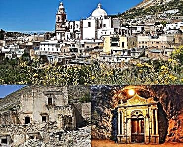
Ixtlahuacán is a region where historical wealth, reflected in the vestiges of the Nahuatl culture, is combined with the natural beauty of its contrasting landscapes.
Although there are several meanings that are attributed to the word Ixtlahuacán, the one most recognized by the inhabitants of this town is "place from where it is observed or watched", composed of the words: ixtli (eye, observe, point of view); hua (where, or belongs to) and can (place or time prefix). One reason for the general acceptance of this meaning is due to the fact that the ancient territory of Ixtlahuacán - more extensive than the current one - was an obligatory passage for the Purépecha tribes who tried to take over the salt flats. Another is attributed to the fact that some of the main battles in the region were fought here to repel the invaders during the Spanish conquest.
Due to these events, it could be assumed that it was a warrior town where, taking advantage of the high altitudes of the hills that surround the place, it was monitored and warned of possible incursions by outside groups. Ixtlahuacán is a municipality in the state of Colima located in the southeast of the state, south of the city of Colima and on the border with Michoacán. In this area, where the richness of the Nahuatl culture is combined with beautiful natural landscapes, there are several sites that are worth visiting. We were in some interesting places that are located near the municipal seat of Ixtlahuacán, the starting point of our tour.
THE GRUTTA DE SAN GABRIEL
The first place we visited was the San Gabriel or Teoyostoc cave (sacred cave or of the gods), located on the hill of the same name. Currently it belongs to the municipality of Tecomán but it has always been considered as part of Ixtlahuacán, since previously it was part of this municipality. We left along the paved road that starts from the Ixtlahuacán square to the south, from which we can see the tamarind fields that are next to the town. After about 15 minutes we continue along a deviation to the right just when the slope of the hill begins.
In the upper part, it is impossible to observe and enjoy an impressive landscape: a small plain in the foreground; beyond, the hills that surround Ixtlahuacán and in the distance, huge mountains that pretend to be the guardians of the place. After an hour of walking we arrived at the community of San Gabriel, we greeted some of the neighbors and a boy offered to accompany us to the grotto that is located a few meters from the houses, but that goes completely unnoticed by those who do not know that there is this wonderful work of nature.
With the certainty that we would be on the right track, we began our journey. About a hundred meters ahead, the guide led us through the undergrowth, 20 m more and there was a large hole of approximately 7 m in diameter surrounded by rocks and a huge tree on one of its banks, which invites the curious to slide along its roots to go down about 15 m to the entrance to the cave. Our companion showed us how “easy” it is to go down with no help other than his feet and hands, however, we prefer to go down with the help of a strong rope. The entrance to the grotto is a small opening in the floor between the stones, where there is hardly room for one person. There, following the guide's instructions, we slipped and were surprised to see an owl that was apparently injured and had taken refuge at the entrance of the grotto.
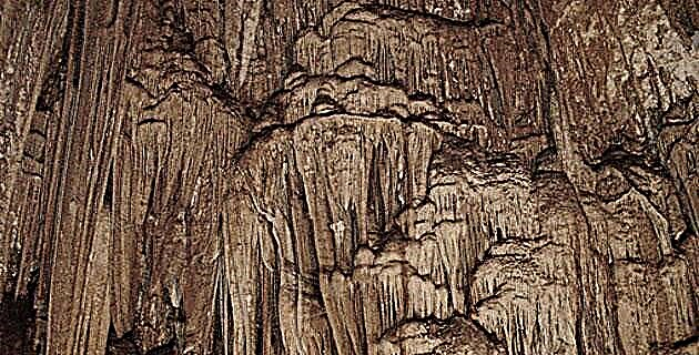
As the light that manages to filter into the interior is minimal, it is necessary to carry lamps to be able to observe the magnificence of the place: a chamber of about 30 m deep, 15 wide and with a height of approximately 20 meters. The ceiling is made up almost entirely of stalactites, which in some cases come together with the stalagmites that seem to emerge from the ground and that together glow when the light is directed towards them. Something sad was to appreciate how some previous visitors, without respecting what nature has formed for thousands of years, have taken large pieces of this natural wonder to take them as souvenirs.
When we toured the interior of the grotto and still ecstatic by its beauty, we saw how, from the entrance hole and downwards, wide stone stairs are formed, which according to explorations and studies carried out, were built in pre-Hispanic times with the purpose of turn this space into a ceremonial center. There is even the theory that the shaft tombs found in the states of Colima and Michoacán and in the republics of Ecuador and Colombia, may have a relationship with this cave or other similar ones, since their structures are similar. It is worth mentioning that in this place, which according to history was located in 1957 by hunters, there is no reference to the findings of archaeological pieces. However, it is well known by the inhabitants of the municipality in various discoveries of the vestiges of the Nahuatl culture there has been almost total looting and that no one can explain where a large number of pieces found are.
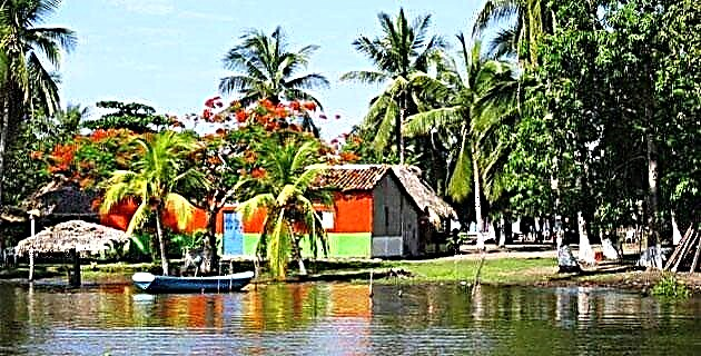
LAURA'S POND
After being enthralled by the imposing images inside the San Gabriel cave, we continue our journey to Las Conchas, a small town located 23 km to the east of Ixtlahuacán. A kilometer ahead of Las Conchas we stopped at a large spot known as Laura's pond, where the trees seem to come together to offer a cool place under its shade next to the Rio Grande. There, on the bank of the river that separates the states of Colima and Michoacán, we saw some children swimming in its waters while we listened to the clear murmur of the river accompanied by the song of the calandrias, whose colors, black and yellow, fluttered through everywhere. Before heading to the next destination, the guide pointed out several nests built by these birds. In this regard, he told us that according to the ancestors, if most of the nests are in the highest places, there will not be many blizzards; On the other hand, if they are in lower parts, it is a sign that the rainy season will come with strong gales.
THE TOMBS OF TIRO DE CHAMILA
From Las Conchas we continue along the road that goes to Ixtlahuacán, now surrounded by large plantations of mango, tamarind and lemon. On the way we were surprised by a little deer that ran past us. How maddening and sad it is to see that some people, instead of enjoying and thanking these encounters, immediately draw their weapons and try to hunt these animals that are increasingly difficult to find.
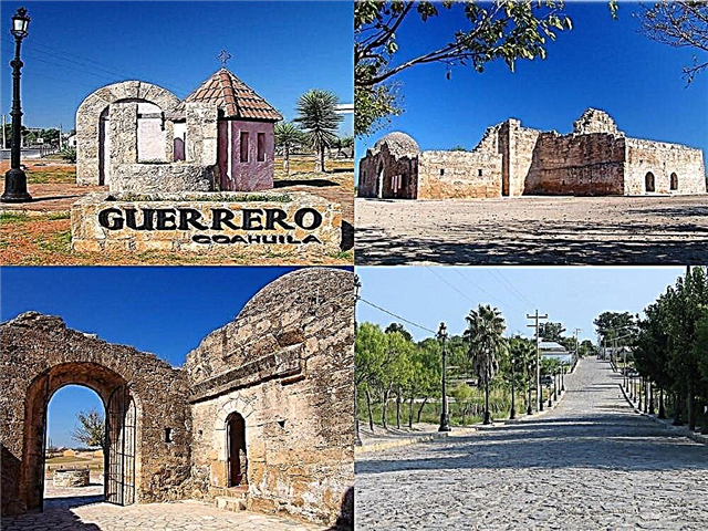
Approximately 8 km from Las Conchas we arrive at Chamila, a community that is located at the foot of the hill of the same name. Passing between a lemon orchard and a corn field we reach a part a little higher than the rest of the land, about 30 by 30 meters, where what was a pre-Hispanic cemetery has been established, since to date they have been discovered about 25 graves. This cemetery corresponds to the Ortices complex, which dates from the year 300 of our era and constitutes one of the main sources of knowledge of the pre-Hispanic period of the state of Colima. Although shaft tombs vary in size, depth and shape, they are considered typical of the region because they were generally built on tepetate terrain, and have a shaft and one or more adjacent burial chambers where the remains of the deceased have been found. and their offerings. The access point to each grave is a well with a diameter between 80 and 120 cm and a depth of between 2 and 3 meters. The burial chambers are about one meter and 20 cm high, by 3 m long, communicating through small holes between some of them.
When the tombs were discovered, the communication of the shot with the camera was generally found to be obstructed by pieces of ceramic or stone, such as pots, vessels and metates. Some researchers point out that the shot grave has great symbolism, as it follows the womb and the grave, it was considered the end of the life cycle: it begins with birth and ends by returning to the womb of the earth. Where the cemetery land ends is a petroglyph, a large stone that has an inscription engraved on it. Apparently it is a map that indicates the location of the shooting tombs in the place, with some lines indicating the communication between them. In addition, something extremely interesting is engraved on the stone: two footprints, one that appears to be that of an adult indigenous person and one that of a child. Again, to our regret, when asking about the archaeological pieces found at the site, the responses from the inhabitants and the municipality authorities indicated that the tombs had been almost completely looted. In this regard, there are those who claim that the loot here obtained by the looters is mostly found abroad.
THE TAKING OF THE CIUDADEL
On our way back to Ixtlahuacán, about 3 km before, we follow a small detour to see La Toma, a beautiful pond that has been used since 1995 as an aquaculture farm, where white carp is planted. When leaving La Toma we observe in the distance, in the lands of “Las haciendas”, several mounds covered with stones that, due to their arrangement in the place, attract our attention. Everything seems to indicate that under the prominences of land there are constructions from the pre-Hispanic era, since their shapes resemble small pyramids that even seem to surround what could be a playing field. Beyond these apparent constructions there are four mounds, in the center of which - according to what they told us and we could not verify due to the growth of the grass - there is what appears to be a stone altar. We were struck by the fact that on the small pyramids there were abundant pieces of scattered pottery and fragmented idols.
This last place on our journey led us to the following reflection: This entire region has been rich in vestiges of one of our ancestral cultures, thanks to which it is possible to get to know each other better. However, there are those who see in this only the benefit of personal gain. Hopefully, they are not the only ones who take advantage of this wealth and that what remains is rescued for the benefit of all, so that in this way the unknown Mexico is less and less.
IF YOU GO TO IXTLAHUACÁN
From Colima take Highway 110 towards the port of Manzanillo. At kilometer 30 you follow the sign to the left and eight kilometers later you arrive at Ixtlahuacán, passing a little before the small town of Tamala. Starting early it is possible to complete the entire route in one day. For the visit to the grotto it is necessary to have a resistant rope of at least 25 meters and do not forget to bring lamps. Before embarking on the expedition, it is convenient to contact Mr. José Manuel Mariscal Olivares, chronicler of the place, at the municipal presidency of Ixtlahuacán, whom we certainly thank for his support in carrying out this report.