The first things that fill the eyes when arriving in Tabasco is green and water; from above the plane or from the edges of the roads, the pupils contemplate water and more water that runs between the banks of some river, or is part of those mirrors of the sky that are lakes and lagoons.
In this state the elements of nature, to which some Greek philosophers attributed the beginning of the world, have great potentiality. When it comes to fire, there is the golden sun, which without the slightest mercy and compassion spills and spreads from the high skies over the fields and the sheet, guano, tile, asbestos or cement roofs of the towns, villages or cities of Tabasco.
If we talk about air, it is also present with its luminous transparency and sharpness. Hundreds of species of birds fly in it, from pigeons to hawks and eagles. It is true that sometimes this air becomes a gale, a hurricane or strong tropical winds that hit the residents who live by fishing on the shore of the Gulf of Mexico or on the banks of the rivers Usumacinta, Grijalva, San Pedro, San Pablo, Carrizal and others who served, in a not too remote time, as the only means of communication.
For this reason, when Hernán Cortés arrived at what is now Coatzacoalcos at the end of 1524, on the way to Las Hibueras (Honduras), he called the Tabasco chieftains to tell him which was the best route to reach that place, they replied that they they only knew the route by water.
In fact, it is not an exaggeration to say that this element assaults us everywhere, not only in the great plains or sliding through the high mountains or among the willows that sadly drop their branches to the current of any river, but also in the waves. calm or raging seas, in swamps, in hidden estuaries where the twisted roots of the mangrove have their kingdom; in the streams that meander between daisies, tulips, golden showers, raspberries, maculises or the imposing rubber trees.
It is also in the darkened clouds that keep all possible storms to drop them on the streets, where some children still play with paper boats or bathe between the flashes of lightning and the roar of lightning; it drops them on the already poor fields of forests and tropical jungles, but rich in pastures that feed the thousands of cattle that populate this state in the southeast of Mexico.
If we speak of the earth element, we have to refer to the fluvial and coastal plains, and the terraces or plains of the Pleistocene, but above all of a fertile womb, where mother earth macerates the seeds so that they burst and grow from that tiny pubis. greatness of the mango or tamarind tree, the star apple or the orange, the custard apple or the soursop. But the land does not only breed large trees, but also smaller shrubs and plants.
As nothing is given separately and everything is part of an organism that creates and recreates itself all the time, fire, air, water and earth come together in Tabasco to create landscapes that are sometimes paradisiacal, sometimes wild or sensual.
It also has a humid tropical climate with high temperatures and vast rains that often bring the trade winds from the northeast, which when caressing the waters of the Gulf of Mexico absorb the humidity and when they reach land they are stopped by the mountains of the north of Chiapas. At this point they cool and drop their waters, sometimes in the form of tropical cyclones from the Gulf or the Pacific, thus forming the great rainfalls of the summer and early fall.
For this reason, of the 17 municipalities that make up the state, the three located next to these mountains are where it rains the most: Teapa, Tlacotalpa and Jalapa.
The strength of the sun, which has already been mentioned before, makes the temperatures very high, especially in the months of April, May, June and July; This season is characterized by a season of extreme drought, for which there are large movements of cattle to areas where the waters do not dry up completely.
The rainy season covers the months that go from October to March, but especially December, January and February. It is because of the above that the lagoons reach their highest level between September and November, which is when the floods occur.
Not only the lagoons but also the rivers increase their volume and go out of their channel, causing the people who live on the banks to abandon their homes and lose their crops.
That is why in Tabasco the soils are formed by hauling materials, by sediments left by the waters when they overflow and return to their normal course. The priest José Eduardo de Cárdenas, considered the first Tabasco poet, said at the beginning of the 19th century that “The fertility of its land watered with beautiful rivers and streams is such and so varied in precious productions, that it can be compared with the most fertile countries ... Spring lives there on its seat ... "
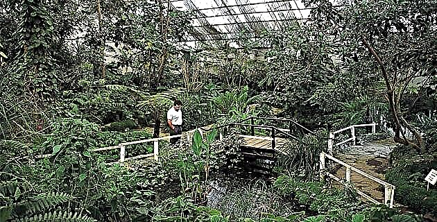
This set of elements: water, air, fire and earth, creates a state in which there is a varied flora and fauna. We can find from tropical rain forest to semidecidual tropical forest, mangrove forest, tropical savannah, beach formation and marsh formation. The fauna in Tabasco is both aquatic and terrestrial.
Despite the great devastation of tropical forests and the excessive and uncontrolled hunting that has been declining and in some cases extinguishing some species, we can still find, although in less abundance than before, the silent beauty of herons, the roar of parrots or parrots at twilight, round, red-eyed rabbits that suddenly assault us on the roads or on any road, deer that occasionally come out from behind some thicket or turtles that are always slower than the clearings to make pastures and change forever the friendly face of nature.
However, those who visit the state will still find green everywhere. Not a green that emanates from the exuberant forests or the jungles that once populated these lands, but from the fields that extend like gardens and that only have here and there some shrubs or isolated groups of trees, but nature at the end and at the end. beautiful cape.
In some parts we can hear the howl of the monkeys at sunset, the maddening song of the birds at sunset on any horizon, the green of the iguanas on the branches of a tree and the lonely ceiba that rises to the sky, trying to decipher its mysteries.
We can contemplate the dexterity of the kingfisher, the serenity of the cranes or pelicans and a diversity of species of ducks, toucans, macaws, buzzards and those birds that open their eyes in the middle of the night to emit strange guttural sounds that awaken superstitions and fear. like the owl and the owl.
It is also true that here there are still wild boars and snakes, ocelots, armadillos and a variety of both salt and fresh water fish. Among these is the rarest of all and the best known in the state, which is the alligator.
But it must be remembered at all times that if we do not know how to take care of and respect the life of all these species, we will be left more and more alone on the planet and of them only the memory will remain that will fade over time and photographs in books and school albums.
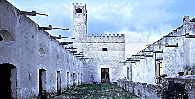
Something that is important to know about Tabasco is that it is divided into four well-demarcated areas with their own characteristics. These are the Los Ríos Region, made up of the municipalities of Tenosique (Casa del Hilandero), Balancán (Tigre, Serpiente), Emiliano Zapata, Jonuta and Centla. The Sierra Region that integrates Teapa (Río de Piedras), Tacotalpa (Land of weeds), Jalapa and Macuspana.
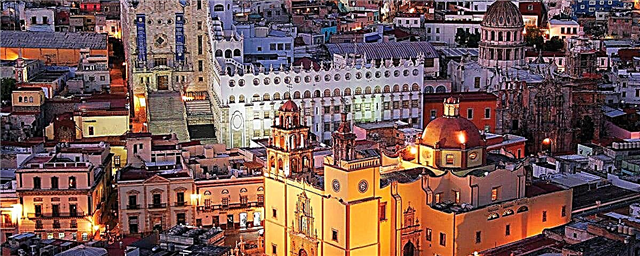
The Central Region that only includes the municipality of Villahermosa and the Region of Chontalpa where we can find the municipalities of Huimanguillo, Cárdenas, Cunduacán (Place that has pots), Nacajuca, Jalpa (On the sand), Paraíso and Comalcalco (The house of the comales). There are 17 municipalities in total.
In the first of these regions we are going to find always flat lands, generally hills that are used for pasture and agriculture, located in the eastern part of the state; It is the part that adjoins Guatemala, where the Usumacinta River is the movable border that marks the limits between Mexico and the neighboring country, but not only of it but also of Chiapas and Tabasco along 25 km.
Lagoons abound in this region and it has a network of very important rivers, from the aforementioned Usumacinta to the Grijalva, the San Pedro and the San Pablo. Its main activity is livestock, as well as the cultivation of watermelon and rice.
It is an area, due to the same livestock activity, where some of the best cheeses in the state are produced, but fishing is also of the utmost importance, especially in the Centla area, next to the Gulf of Mexico, where the Pantanos are, considered not only a natural beauty but one of the largest ecological reserves that exist.
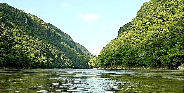
Usumacinta River
It is considered the largest river in the country. It is born in the highest plateau of Guatemala called “Los alto Cucumatanes”. Its first tributaries are the "Rio Blanco" and the "Rio Negro"; From the beginning it marks the limits between Mexico and Guatemala, and throughout its long journey it receives other tributaries, among which are the Lacantún, Lacanjá, Jataté, Tzaconejá, Santo Domingo, Santa Eulalia and San Blas rivers.
Passing through an area called Boca del Cerro, in the municipality of Tenosique, the Usumacinta expands its channel twice and becomes a truly imposing river; further on, on an island called El Chinal it forks, keeping its name the one with the largest flow, which runs north, while the other is called San Antonio. Before they rejoin, the Palizada river emerges from the Usumacinta, whose waters flow into the Terminos lagoon. A little further down the San Pedro and San Pablo rivers separate.
Later the Usumacinta forks again and the flow from the south continues, while the one from the north takes the name of San Pedrito. These rivers meet again and in doing so they are joined by the Grijalva, in a place called Tres Brazos. From there they run together to the sea, to the Gulf of Mexico.