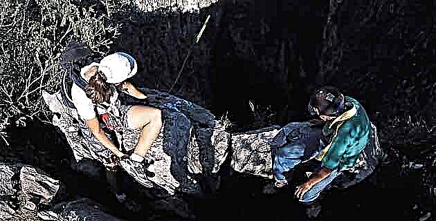
This place, ideal for high mountain sports, will teach you what a high altitude trip is.
A complicated topography will accompany you along the way to the inhospitable foothills of the Sierra Madre Occidental, where the huge canyon sinks, and at the bottom of which the Remedios River meanders. Here you will discover a large number of landscapes and corners, many of them unexplored, which allow you to enjoy the wooded landscape and a large number of elevations where you can practice high mountain sports.
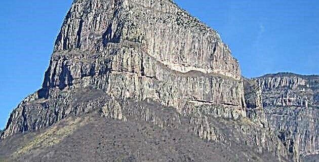
The winding roads are of a singular beauty and at times they seem to get lost in the dense coniferous forest. Among the sites of importance for mountaineers, are the Alto Tarabilla hill, just before reaching Los Altares, which has an altitude of 2,860 meters above sea level, and the famous Los Monos hill, 8 km to the southeast from the town of Sapioris, with its steep vertical walls that reach 2,600 meters above sea level.
This region is populated by a great variety of fauna, among which specimens of deer, badger, squirrel and a huge number of birds stand out. For those who like strong emotions, many of the corners of this region are a real challenge.
How to get:
San José de Bacís, 172 km northwest of the town of Santiago Papasquiaro on highway 23. After 10 km, turn left and 68 km to Los Altares; continue 65 km south along a gap and dirt road to the town of Cardos, and 6 km ahead is the town of Sapioris.