Las Haciendas is a strip of land that is surrounded by the Pacific and the huge estuaries that are part of the national marshes.
Las Haciendas is a strip of land that is surrounded by the Pacific and the huge estuaries that are part of the national marshes.
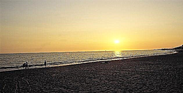
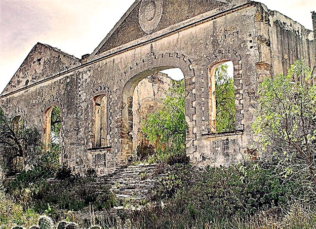
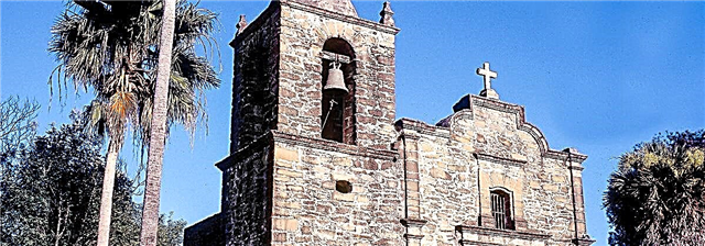
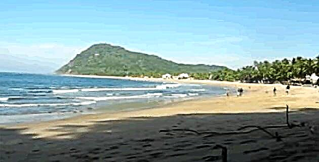
In the north of the coast of Nayarit there is a strip of land of more than 100 km in length that includes wonderful beaches and exotic communities, such as Rancho Nuevo, San Andrés, Santa Cruz, Puerta Palapares, Palmar de Cuautla, El Novillero and San Cayetano, among others. Since the beginning of the last century, an important cattle industry was established there that operated with enormous success for several decades, during which time three farms were built; Of these, only that of San Cayetano has not succumbed to the passage of time, as happened with those of Santa Cruz and Palmar de Cuautla, which have practically disappeared; however, the locals still refer to the region as "Las Haciendas".
This strip of land is connected to the rest of the state by a highway that goes from Tuxpan to Santa Cruz and another from Tecuala to Playas Novillero, this only from 1972, since before it was totally isolated.
The Haciendas have always had a close relationship with the island of Mexcaltitán, especially commercial, a link that dates back to pre-Hispanic times, when the Aztecs inhabited the region. Today there are numerous vestiges (figurines, ceramics, arrowheads) that we can discover among the impressive shells or shells, which are huge mounds formed by millions of shells of the different mollusks that the natives consumed; the shells were piling up in one place to create large clusters from which they could be seen from several kilometers away. Nowadays the local roads are also covered by these shells, which makes them white and shiny, visible even at night.
This entire region belonged, long before the arrival of the Spaniards, to the Chimalhuacán confederation, which was made up of four kingdoms: Colima and Tonatlán to the south, and Xalisco and Aztlán to the east, based in the current state of Nayarit.
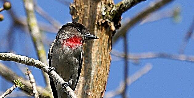
In the Nonoalca manuscript the Aztecs are called Aztatlecas; the first name was the true one, but the second was used for euphony; thus, Aztatlán, “a place where herons abound”, became Aztlán, the original homeland of the Aztecs.
The kingdom of Aztlán comprised a great extension that went from the Santiago river to the Umaya river. The most important towns of then and that still conserve their names are: Ytzcuintla, Centizpac, Mexcaltitán, Huaynamota, Acatlán, Acaponeta, Tecuala and Acayapan. The capital of the kingdom was Aztlán, today San Felipe Aztatán, municipality of Tecuala.
In Aztlán Huitzilopochtli was worshiped, a deity who centuries later would rule the entire Aztec empire. In 1530, King Corinca ruled the kingdom of Aztlán, who along with his mansions had annexes where tigers, alligators and other animals were held captive, as well as beautiful ornamental plants that were the delight of his courtiers and guests.
Finally, Aztlán was besieged by a large army made up of Tlaxcalans and Tarascan Indians and 500 Spaniards under the command of Beltrán Nuño de Guzmán.
At the beginning of the 19th century, Las Haciendas belonged to a famous cattleman from Tuxpan, Don Constancio González. The San Cayetano hacienda, founded approximately in 1820, achieved great fame for its cattle and for its abundant cotton production, as well as for its excellent jerky, which was traded in Tepic, Guadalajara, Tuxpan and Santiago. The production of the salinas, where many of the farm laborers worked, was also important.
The rancherías that today extend along this coastal strip had their origin at the beginning of this century; later, at the end of the 1930s, the government seized the bosses and the ejidos began to form.
The traditional dwellings of the time, still visible today, had three rooms: an open room (where visitors were received), the kitchen (parapet) and the bedroom, made with mangrove sticks and covered with adobe; the roofs were made of palm.
Today the courtyards and the surroundings of the houses are adorned with a rich variety of flowers and plants. Regarding their activities, the locals live off the fishing that abounds in the marshes (shrimp, mojarra, curbina, snapper, snook, oyster). Shrimp are still fished with the old pre-Hispanic system of tapos, especially from July, with the rains. Likewise, fishermen go down to eight strokes to collect the oyster in pleasure, that is, the one at the bottom of the sea.
Agriculture is also important; for example, two varieties of watermelon are grown, the "calsui" and the "black", in 90-day cycles, in winter and spring, if the breeze is not too salty.
Besides watermelon, the production of green chili, sorghum, coconut, banana, papaya, tomato, lemon, cane, cocoa, peanut, soursop, tobacco and mango is considerable.
The growth of the communities had a lot to do with the fact that the local fishermen recovered the lake region from the fisheries, where shrimp abound, which were traditionally in the hands of the Mexcaltitán fishermen.
At the beginning of the last century, a large number of African slaves arrived in this coastal region of northern Nayarit, as part of the slave trade that was carried out through the ships of China, coming from the Philippines. In the region, it is said that many of these blacks arrived here after one of those boats sank and the survivors reached the beaches of San Cayetano, Puerta Palapares and El Novillero by swimming. Today, when one travels this coast, the Afro-Brazilian influence among its inhabitants is perfectly perceptible.
As a curious fact, there are those who assure that here are the best dancers in the country; in Rancho Nuevo we were able to see a group of them dance throughout the night, to the rhythm of the music that local bands play at half light, in the rooms of the humble but beautiful farmhouses
IF YOU GO TO THE HACIENDAS
To get to this region of Las Haciendas you have to take federal highway no. 15 that goes from Tepic to Acaponeta, where you follow the state highway no. 3 to Tecuala and then continue to El Novillero. Once here, to the north you reach San Cayetano, and to the south to Palmar de Cuautla, Puerta Palapares, Santa Cruz, San Andrés, Rancho Nuevo and Pesquería.
Source: Unknown Mexico No. 275 / January 2000