In 1524 Hernán Cortés commissioned his nephew Francisco Cortés de San Buenaventura to "discover new lands." It left Colima in 1525 and after crossing the state of Jalisco, it passed through Ixtlán del Río and reached Ahuacatlán. The religious work was carried out by the Franciscan friars of the province of Michoacán. Fray Francisco Lorenzo took over Ahuacatlán, in the state of Nayarit, in 1550, thus establishing the first convent.
Our tour begins in this town rich in natural landscapes and water sources, today converted into spas for being the natural gateway to the mountains of the municipality of Amatlán de Cañas.
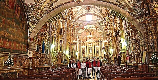
Its Franciscan temple built in 1680 particularly caught our attention, although certain elements are later. The cover is of two bodies; In the first, the access has a voussoir semicircular arch and fluted pilasters on the sides. The portal is flanked by two attached columns with Corinthian capital; in the second body you can see a rectangular choral window and above it a niche with the sculpture of Saint Francis.
The interior has a single nave with a groin vault and a neoclassical altarpiece. In front of the façade there is a sculpture of "Saint Francis and the Wolf" in quarry, on a rectangular base with relief of the Franciscan symbol.
On the other side of the Plaza de Ahuacatlán stands another magnificent temple: that of the Immaculate, dating from the seventeenth century. Its façade is made of stone, it has a single-body portal with access through a semicircular arch and with lateral pilasters, flanked by two wide towers; the top of the portal is semicircular with a niche and quarry cross. On the right side is the tower with a pyramidal finish.
In the center of the square there is a kiosk with decoration on the ceiling of vegetal figures cut out of sheet; Around benches and green areas complement it.
After tasting some delicious quail in one of the restaurants near the square, we headed down a winding dirt road towards the old mining region of Amatlán de Cañas. This is located in the foothills of the Ceboruco volcano, between the Sierra de Pajaritos, which resembles a wall between Amatlán and Ahuacatlán, and the Sierra de San Pedro, to the north. Nature favored this mountainous area by endowing it with lush valleys.
Amatlán de Cañas forms the southern corner of this region: it is located on the border with Jalisco, and enclosed by mountains it sits in a valley between the stone wall and the Ameca river.
It is a special, strange and beautiful saw. It was sculpted by the waters from a block of volcanic rock and that leads us to suppose that millions of years ago it housed powerful volcanoes that vomited thousands of cubic kilometers of rock that currently make it up.
Little by little the streams, and later the rivers, found their way to the sea there and patiently dug into the rock the stepped canyons that give it its identity. That is why many tables have survived in the mountains, all remains of what was originally fragmented.
This landscape of flattened peaks and deep canyons is surrounded by pine and oak forests, which spread over the heights like blue-green brushstrokes that soften the abrupt and ruggedness of the region and cling to the slopes.
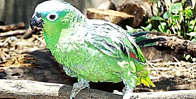
Here you will find refuge for white-tailed deer, foxes and squirrels; eagles and hawks reign in the ravines.
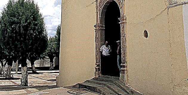
The first town we come across is Barranca de Oro, at the entrance of which you can still see vestiges of what was an old hacienda: walls, niches, a small chapel and some tower are just some of the elements that remain and that speak to us. of the majesty of the building during the mining boom in the 18th and 19th centuries.
The town is practically abandoned, you can only see facades, gates, windows and rich textures that time has sculpted.
Continuing through narrow and nostalgic alleys, you reach the road that leads to the town of El Rosario, just two kilometers away. This picturesque town, like the entire region, was founded by Francisco Cortés de San Buenaventura, who quickly realized the enormous wealth that existed, mainly gold and silver.
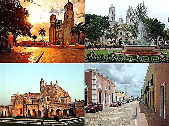
The main attractions of El Rosario are the Temple of the Virgin of the Rosary, a single-body building with a tower and bell tower of excellent manufacture and a splendid atrium.
The main square harmonizes with the temple. Buildings with thick columns and wide portals, a central garden with lush vegetation and a beautiful stone fountain that peeks out from the thick foliage that surrounds it.
Its cobbled and narrow streets, the houses with typical tile roofs and its landscaped areas make El Rosario a beautiful corner of the Sierra Nayarita, which in addition to its architectural attributes has a splendid spa: El Manto, which is nestled in a canyon and Surrounded by jungle vegetation through which the sun's rays filter, it undoubtedly offers a fantastic spectacle of light and nature.
To descend through the canyon there is an access of stairs that lead to several semi-natural pools fed by outcrops of warm and crystalline spring waters that form a waterfall that resembles a mantle, for which the place receives this name. In the Manto you can swim, fish and enjoy delicious dishes based on freshwater fish.
The most recommended season to enjoy the site is from November to June; the rest of the year as a result of the rains the waters become cloudy and the currents increase.
Just six kilometers from El Rosario is another typical community of the region that is, without a doubt, where the best examples of vernacular architecture in the state are preserved: Estancia los López.
At the entrance of the town we find vestiges of what was the Hacienda de Quesería, where cheese, peanuts and coffee were made.
Even today you can see machinery from the last century that was used in the hacienda's coffee and peanut production at the time.
The enormous "chacuacos" (chimneys) that still stand as mute witnesses of the rise of this small corner of the mountains are also impressive. Today some locals work in sugarcane, this municipality is part of the so-called "sweet navels" of the state, important cane producers. Others are cattle ranchers, but most are dedicated to traditional crops: corn, beans, sorghum, and so on.
People are occasionally seen in the square or in the portals of the old houses, the cobbled streets look deserted during the day. Many young people look for work in other places, and those who remain in the town take shelter from the heat in the cool patios of the old houses; others with less luck work in the sowing and will only return at the end of the afternoon. At Estancia Los López, time stopped: alleys, sidewalks, facades, wooden gates, everything remains the same, as if, suddenly, everyone had left and never returned.
Seven kilometers from Estancia Los López is the municipal seat, Amatlán de Cañas, where the river of the same name passes and is one of the tributaries of the great Ameca river, which flows into the Bahía de Banderas region.
Amatlán de Cañas also has the Garabatos and Barranca de Oro streams. The town, like all those in the region, is picturesque and nostalgic; It was famous for its gold veins that, although with a production that does not compete with the times of the great boom of the seventeenth to the nineteenth centuries, gold, silver, copper, zinc and other minerals are still exploited. Today only some locals are dedicated to mining and the rest to agriculture and livestock.
One of the main attractions of the place is the Parish Temple dating from the 18th century, where the image of the Lord of Mercy is venerated. The original construction has undergone modifications, such as the change of the main access that is now located on the side portal; This is formed by a body that supports the tower which, in turn, consists of two bodies and a dome top.
The main portal is of a body, with access of a semicircular arch flanked by paneled pilasters; its interior has a single nave with a barrel vault and a neoclassical altar.
Less than two kilometers from the center of town, along a dirt road that crosses the Amatlán de Cañas River, you reach a splendid area of springs on the river bank that look like steam sprouts originating from the current of a stream which is formed from hot springs with temperatures up to 37 ° C. The place is perfect to enjoy the warm waters and totally relax, in addition to giving you a gentle massage.
If after bathing you still have energy, the place is ideal for walking and getting to know some of the gold and silver mines that exist on the slopes of the mountain. To carry out this expedition it is important to be accompanied by a guide from the region.
It is not difficult to imagine the Franciscan missionaries, who first arrived in Amatlán de Cañas in the distant 16th century, walking through its streets.
Source: Unknown Mexico No. 289 / March 2001