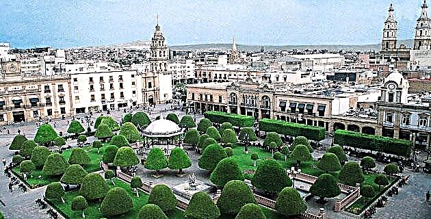
Mexico City has undergone numerous transformations, so each period of its history is forged with the remains of the previous one. Due to the logical changes of a metropolis, this continuous destruction and reconstruction begins in pre-Hispanic times and continues to this day, as the current rescue project of the Historic Center.
Mexico City has undergone numerous transformations, so each period of its history is forged with the remains of the previous one. Due to the logical changes of a metropolis, this continuous destruction and reconstruction begins in pre-Hispanic times and continues to this day, as the current rescue project of the Historic Center.
Founded in 1325, Mexico City was the seat of the Aztec lordship, during which time it dominated a large territory. In pre-Hispanic times, a straight and geometric scheme was designed that integrated canals and access roads, an arrangement that has marked its appearance to the present day. Then the destruction and reconstruction was done by transforming the existing works, such is the case of the temples and pyramids "each new tie of years" - the equivalent of 52 years of ours. With the symbolic birth of the Sun, additions were placed on the structure of the preceding stage; Likewise, each cycle was celebrated with the destruction of furniture and vessels to release everything in the new era, which explains the finding of fragments in archaeological excavations.
Later, the conquerors lived within the plot, where they were granted various properties. In fact, the plan that the Spanish Alonso García Bravo made for the reconstruction of the city preserved much of the initial scheme. Many times it has been tried to imagine what would have happened if the beauty of Greater Tenochtitlan had been respected and the Spanish had built another contiguous city, but the interests of the Conquest undid this hypothesis.
The following transformation of the city led it to be the seat of the viceregal government of New Spain and its design was built on the ruins of the indigenous city after it was razed. In this adaptation, the main roads were preserved, such as Tenayuca, now known as Vallejo; Tlacopan, present-day Mexico Tacuba, and Tepeyac, now Calzada de los Misterios. The four indigenous neighborhoods that during the viceroyalty changed their names in Nahuatl due to the influence of Christianity were also respected: San Juan Moyotla, Santa María Tlaquechiuacan, San Sebastián Atzacualco and San Pedro Teopan.
Thus, "the colonial city was built on the ruins of the indigenous city, removing the rubble of the collapsed palaces and temples, building the new ones on their foundations, taking advantage of the same materials," according to Luis González Obregón in his book Las Calles from Mexico. The biggest change took place when the city lost its lake characteristics after the works to dry up Lake Texcoco, carried out in the 16th century and concluded in 1900.
To a large extent, during the Colony the city was formed from religious needs. In this regard, González Obregón refers again: “in the seventeenth century the colonial city grew in population and buildings, and the streets and squares were invaded by new monasteries, churches, hospitals, hospices and schools, and less profane than the colonial city of the 16th century, the 17th century was more religious, almost blessed ”.
Already in the 19th century it was the seat of the federal powers after Independence and underwent great changes over the years, among them the disappearance of the convents after the Reform laws and the stage of public constructions of the 20th century. This would be another period of destruction, since we could have three cities: the pre-Hispanic, the viceregal and the reformist.
An important change took place at the end of the 1910 Revolution, when by decree the zócalo, Calle de Moneda and buildings of historical value were protected. Starting in 1930, a new historical awareness of the architectural value of the city was created, which was considered the most important population center in the American continent; then it housed the totality of the public administration, financial activities, commercial organizations and the main house of studies, the National University. The decrees introduced expressed concern to preserve it and prevent uncontrolled growth and the deterioration of its urban image.
THE EXODUS
Due to the deterioration, from 1911 the population began to vacate the center and its inhabitants were concentrating mainly in the colonies of Guerrero, Nueva Santa María, San Rafael, Roma, Juárez and San Miguel Tacubaya. On the other hand, new avenues were created to solve the growing traffic problems and in 1968 the first metro lines were inaugurated with the purpose of supporting public transport; however, the problem continued due to population growth and the number of vehicles.
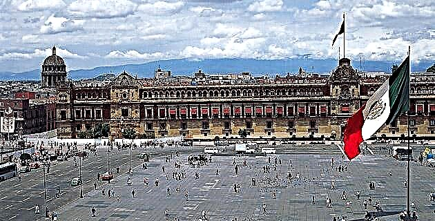
On April 11, 1980, after the discovery and location of the Templo Mayor and the Coyolxauhqui, a decree was issued declaring the historic center of Mexico City as an area of historical monuments, which marked the limits in 668 blocks with a extension of 9.1 kilometers.
The decree subdivides this area into two perimeters: A contains the area that covered the pre-Hispanic city and its extension in the viceroyalty until Independence, and B includes the extensions carried out up to the 19th century. Likewise, the decree of 1980, which protected buildings and monuments from the 16th to the 19th centuries, considered the conservation and restoration of architectural and cultural heritage essential as part of the country's urban development plans.
DISTRIBUTION OF THE HISTORICAL CENTER OF MEXICO CITY
It has just over 9 km2 and occupies 668 blocks. There are about 9 thousand properties and around 1 500 buildings of monumental value, with constructions made between the 16th and 20th centuries.
FOR SAMPLE ...
Iturbide Palace was built in the 17th century for the Marquis of San Mateo de Valparaíso and is an example of Baroque architecture with Italian influence. It was designed by the architect Francisco Guerrero y Torres, who was also the author of the Palace of the Counts of San Mateo Valparaíso and the Capilla del Pocito in the Basilica of Guadalupe; Its frontispiece is of several bodies and the patio is surrounded by fine columns. It has access through the streets of Gante, Bolívar and Madero. This palace owes its name to the fact that Iturbide inhabited it when he entered Mexico at the head of the Trigarante army. For a long time it was a hotel, it has been perfectly restored and is currently occupied by a museum and Banamex offices. However, it can be visited by the public. It is among the illuminated buildings in the Historic Center Trust Program.
At the corner of September 16 –before the Old Coliseum– and Isabel la Católica –before Espiritu Santo– is located the Boker Building, built in 1865 to house the hardware store of the same name. It was designed by the architects De Lemus and Cordes, from New York, authors of the famous Macys store in that city, and executed by the Mexican Gonzalo Garita, who also carried out the construction of the Independence Monument and the foundations of the Palace. of Fine Arts. This property has a sister building, the one that houses the Bank of Mexico, executed by the same architect and builder; It was inaugurated in 1900 by Don Porfirio Díaz and at the time it was considered the most modern in Mexico, since it was the first to be built with columns and metal beams. It is considered a historical and architectural monument of the city.
Among some anecdotes of the property, it is said that during its construction, Cihuateteo, the mother goddess who is currently in the Munal, and the decapitated eagle, were found in the National Museum of Anthropology. Its owner, Pedro Boker, has participated directly in the rescue works carried out on those streets and tells us that there have been three neighbors for each of the roads, who take part in the supervision of the works.
RESCUE ACTIONS
The growing deterioration of the center includes economic, social, political and urban image aspects, so a rescue plan must take them into account with a view to saving our historical and cultural values.
The current project for the regeneration of the Historic Center is headed by the Trust of the Historic Center of Mexico City, directed by Ana Lilia Cepeda, and comprises a set of directed and complementary actions, which in a period of four years (2002-2006) will produce a positive impact on the urban space.
ECONOMIC ASPECTS
In this sense, they propose to ensure profitability in investments, guarantee real estate investments, rethink the use of buildings, reactivate the area economically and generate jobs.
SOCIAL ASPECTS
On the other hand, it seeks to revitalize and recover the habitability conditions of the area, strengthen the roots of the families that inhabit it, as well as solve the problems of commerce in the public thoroughfare, insecurity, poverty and human deterioration.
STAGES OF THE RESCUE OF THE HISTORICAL CENTER THROUGH ITS REGENERATION PROJECT
First (all three from August to November 2002):
It included the streets of 5 de Mayo, Isabel La Católica / República de Chile, Francisco I. Madero and Allende / Bolívar.
Second:
It covers the streets of 16 de Septiembre, Donceles, from Eje Central to República de Argentina, as well as two sections of Palma, between 16 de Septiembre and Venustiano Carranza, between 5 de Mayo and Madero
Third:
It carries out works on the streets of Venustiano Carranza, from Eje Central to Pino Suárez, the remaining sections of Palma, one of February 5, between September 16 and Venustiano Carranza. In Motolinía Street, the floors and flower beds were rehabilitated, and at the request of the neighbors, the section between Tacuba and 5 de Mayo was converted into a pedestrianized area.
Fourth stage: (from July 27, 2002 to October 2003). It included the street of Tacuba (streams, garrisons and sidewalks).
URBAN IMAGE PROGRAM
It intervenes in aspects of the urban landscape with a sense of respect for the historical heritage; They are conservative interventions, which include the arrangement of facades, lighting of buildings, urban furniture, transportation and roads, parking, ordering of commerce on public roads, and garbage collection.
LIGHTING PROJECT
The lighting of the buildings highlights their beauty for night tours. Among those enlightened in the program are:
• In Isabel La Católica La Esmeralda, the Spanish Casino, the House of the Count of Miravalle and the Boker House.
• In Madero, lighting was designed in the Temple of San Felipe, the atrium of San Francisco, the Palace of Iturbide, La Profesa, the Casa Borda and the Pimentel Building.
• On May 5, lighting was installed in Monte de Piedad, Casa Ajaracas, the Paris Building, Motolinía and May 5, Palestina, as well as the facade of the Building of Weights and Measures.
AMOUNTS AND PERSPECTIVES
The Urban Development Program of the Historic Center implies an investment of the Federal District government of 375 million pesos (mp) in infrastructure actions, urban image and property acquisition. Private investment amounts to 4,500 million pesos in projects for the purchase of real estate and the installation of shops, restaurants and other businesses.
This transformation is the most important since 1902, the last time streets were opened and infrastructure was renovated. It is a conservative project of the values of the historic area, in which the government of the Federal District, the National Institute of Anthropology and History, the National Institute of Fine Arts, art historians, restorers, architects and urban planners participate. The Center will undoubtedly regain much of its splendor.
Source: Unknown Mexico No. 331 / September 2004