Following in the footsteps of the great sailor and adventurer Sebastián Vizcaíno, we decided to enter in 4x4 vehicles in one of the most extensive reserves in the world and the largest in Mexico.
Half a century after the death of Hernán Cortés, Sebastián Vizcaíno, a good soldier and sailor, set out to sea in command of his three ships in search of new adventures and discoveries, with the sole mission of conquering the Californias.
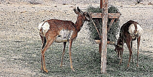
Vizcaíno left the port of Acapulco and followed the Cortés route, along the Pacific Ocean to Cabo San Lucas. Finally, in October 1596 he disembarked in the Bay of Santa Cruz, named after Hernán Cortés because during his trip he discovered it on May 3, 1535.However, Vizcaíno changed its name to Bahía de la Paz, the which he has preserved to date, since upon his arrival the Indians gave him a great welcome and offered him fruits, rabbits, hares and deer.
Vizcaíno went into the Gulf of California, and during his trip he had to face the strong and treacherous currents and tides of the Sea of Cortez. The northwesterly winds, whipping the sails, pushed the ships in the opposite direction, making progress difficult. However, on that occasion he reached the 27th parallel where he discovered the infinite marine riches of the gulf: enough pearls and fish to fill ships and boats.
He then returned to the Bay of Peace where he resupplied, left some sick men and continued his expedition along the coast of the Pacific Ocean. On this occasion he reached the 29th parallel, but since the ships and crew were in very bad condition, he had to return to New Spain.
Years later, at the command of the Count of Monterrey, Vizcaíno undertook his second expedition. On this occasion the objective was not to conquer lands and colonize them, not to seize the wealth and confront the Indians of the peninsula. The mission was scientific in nature and recognized wise men and scientists such as the cosmographer Enrico Martínez participated in it.
During six months the scientific mission would have to observe eclipses and the direction of the winds; anchorages, bays and ports were noted; suitable campsites and pearl fisheries; The geography of the region was analyzed and drawn, marking islands, capes, overhangs and any accidents on the ground in order to prepare the first detailed maps of the peninsula that until then was still considered an island. The expedition sailed from Bahía and Isla Magdalena and Margarita to Bahía Ballenas and Isla Cedros. The result of this mission was the first detailed map of the Pacific coast.
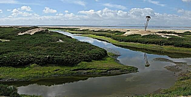
The Vizcaíno Biosphere Reserve is the largest in Mexico; It is located in the state of Baja California Sur in the municipality of Mulejé. It covers an area of 2 546 790 ha, which represents 77% of the municipal area.
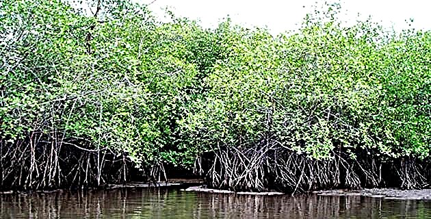
The reserve extends from the mountains of San Francisco and Santa Marta to the islets and islands in the Pacific Ocean; covers the Vizcaíno desert, Guerrero Negro, Ojo de Liebre Lagoon, California slope, Delgadito Island, Pelícano Islands, Delgadito Islets, Malcob Island, San Ignacio Island, San Roque Island, Asunción Island and Natividad Island, and was decreed as such November 30, 1988. The historical, cultural and natural wealth of the region is impressive. There are some enigmatic cave paintings, with all their mystery, that still represent a real puzzle.
We leave behind the shade and the freshness of the vegetation of San Ignacio to enter the desolate desert. After the town of Vizcaíno we start our off road trip through the winding dirt roads that seem to end in infinity. Some lights began to appear on the horizon and after a few kilometers, a neon light sign that turned on and off welcomed us; It was the Bahía Tortugas cabaret.
We walked through the town among American pick-ups and wooden houses eaten by the saltpeter, in search of a good lobster or some abalone. The populations of the North Pacific live on these two products.
The next day we continued our journey towards the desert, but not before passing through a junk dump located on the outskirts of Bahía Tortugas. The remains of rusted vehicles, tires and the remains of huge military amphibians gave a futuristic image of abandonment and desolation. We came to the end of the gap: we were in Punta Eugenia, a population of lobsters and abalone trees located in the extreme northwest of the spit of land that forms the southeast of the coast of the Bahía de Sebastián Vizcaíno. From this point we went to sea in a fishing boat and we could contemplate the gigantic sargassum that inhabit the seabed. Our objective was to know the fauna of the islets; marine mammals such as sea lions and elephants as well as hundreds of ducks, cormorants and pelicans. During the days we were there we could imagine what Sebastián Vizcaíno felt when contemplating so much beauty in that beautiful place. What we know today as the Vizcaíno Reserve is the heritage of the world, not of the Japanese companies and the occasional vivillo, and it is the duty of men to respect, protect and conserve it.
Source:Unknown Mexico No. 227 / January 1996
Photographer specialized in adventure sports. He has worked for MD for over 10 years!