As wild and powerful as it was in the days of Captain Juan de Grijalva, the river is an untouched force that rises in the high mountains of Guatemala.
As wild and powerful as it was in the days of Captain Juan de Grijalva, the river is an untouched force that rises in the high mountains of Guatemala and once it collects the waters of the Lacantún, the Usumacinta enters Mexican territory with all its current. fast and deep until it makes its triumphal entry into the magnificent canyon of Boca del Cerro.
It continues its course in a southeast-northwest direction and makes its way through gigantic meanders between valleys and mountain ranges cutting its way in the limestone rocks, shales and sandstones of the Cretaceous, which rest on a deeper layer formed by deposits of the Jurassic.
Once it collects the waters of the Lacantún, the Usumacinta enters Mexican territory, where it is defined by its deep and fast current; shortly after, it borders the opulent Mayan city of Yaxchilán, then its waters become unfathomable, the banks gain height and the first rapids appear in the imprisoned river, that of Anaité, which is followed by El Cayo, Piedras Negras and finally San José, at from which it rushes between gorges opened by force of millennia by river erosion.
AFTER A WINDING TRIP OF 200 KM
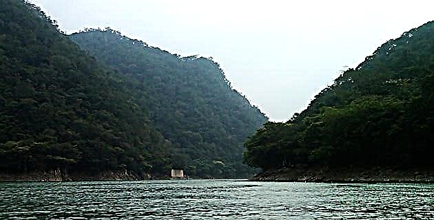
Finally, the sacred river of monkeys makes its triumphal entry into the magnificent Boca del Cerro canyon, an imposing work of nature flanked by monumental cliffs 200 m high, which contrast with the bright orange color of the metal bridge that crosses it in its North side. Due to its scenic beauty and biological diversity, this canyon is one of the most notable attractions in the municipality of Tenosique, in Tabasco, around which stories revolve about immense caves that reach the ruins of Palenque and tunnels dug in time immemorial.
To unveil these mysteries, as always I am accompanied by Pedro García Conde, Amaury Soler, Ricardo Araiza, Paco Hernández and Ramiro Porter; Our adventure begins at the San Carlos pier, from where we leave in the morning.
THROUGH THE FLOW
With an average width of 150 m and a wonderful emerald green color, the flow of the Usumacinta is passable for several kilometers, which allows you to admire at pleasure the high walls that rise from side to side of the canyon and the jungle festoons that they cover even their highest peaks. We ask our boatman, Apolinar López Martínez, to take us to the rapids of San José, and from there begin the exploration downstream.
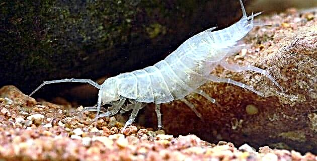
During the navigation we do not lose detail of the splendid tropical vegetation that lines the cliffs and banks. Formerly the king of these places was the mahogany (Swietenia macrophylla), which rose up to 50 or 60 m proclaiming its plant greatness in the Mayan jungle. Today there are some specimens in the most remote places of Lacandonia, but their place has been occupied by other no less stout species such as El Ramón, Canshán, Pukté, Mocayo and Bellota gris. Howler monkeys, jaguars, ocelots, tapirs, white-tailed deer, bats, and an endless number of birds and reptiles live there.
When we get too close to shore, the noise of the engine alerts a group of howler monkeys (Allouatta palliata) resting in a tree; outraged, the Saraguatos dedicate us a concert of raucous shouts that are heard throughout the canyon. No zoo in the world, no matter how modern and functional, is capable of offering this wonderful painting that we greatly enjoy. Further on, on a steep bank and camouflaged by vegetation, we sighted a white-tailed deer.
A MONUMENTAL LANDSCAPE
Between the rapids of San José and San Joseíto we explore a cave, not very deep, but the surrounding landscape is wonderful, made up of monumental blocks of broken rock in which rocky shelters abound, natural arches and crevices ideal for climbing.
Back on the river we sail towards the site where the tunnels are located; When asked if he knows anything about them, Don Apolinar answers that there are 12 of them and they were excavated by the Federal Electricity Commission between 1966 and 1972 to study the geology of the region. Here, the Usumacinta riverbed has a width that ranges from 150 to 250 m, and although on the surface it appears serene and calm, underneath it moves with fearful force and speed, capable of dragging the most expert swimmer to the bottom. Perhaps for this reason the boats that cross its waters are particularly narrow, to achieve a more agile and fast maneuverability.
In a few minutes we are in front of an open tunnel in the west wall of the canyon, at a height of eight m above the river level; the tunnel is rectangular, with a 60 m long gallery and two short side passages. A second tunnel is located on the opposite wall. It is almost a replica of the one we just explored, but slightly larger and wider, with a gallery length of 73.75 m and a side passage on the left side measuring 36 meters.
Lizards, bats, spiders, and crawling insects are the tenants of these artificial cavities not without surprises, in whose interior are animal bones, stopes, cable for explosives –permacord– and of course delicate calcite concretions product of leaks of water saturated with carbon dioxide.
THE DOMAINS OF PAKAL
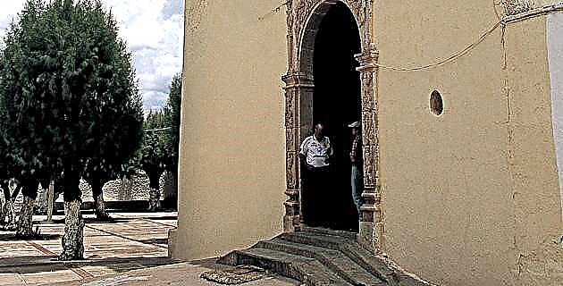
Near here are two caverns, the first on the banks of the river. Although legend has it that it reaches the domain of King Pakal himself, it is only 106 m long; the second amply rewards our efforts; It is a fossil cavity, with galleries and extensive rooms on two levels, in which beautiful sets of stalactites decorate the vaults at 20 m high. Although Don Apolinar explains that the cave was discovered by mountaineers years ago, the ceramic pieces at the entrance show the ritual use that was given to it in pre-Hispanic times.
These vestiges remind us that in addition to its natural importance, the Usumacinta has enormous historical significance, since in ancient times it was the axis of interaction of the Mayan civilization of the classical period, as well as its tributaries. It is estimated that in the times of greatest splendor of the Mayan culture, towards the year 700 of our era, just over five million people inhabited the region. The cities of Yaxchilán, Palenque, Bonampak and Pomoná express the archaeological importance of the Usumacinta, as do thousands of other smaller sites.
Taking into account the above and in an attempt to preserve it for future generations, the government of the state of Tabasco is in the process of integrating this beautiful place into the System of Protected Natural Areas, for which it would provide it with an area of 25 thousand ha with the name of the Usumacinta River Canyon State Park.