Enjoy a weekend full of jungle and water, archaeological sites and a culture that will leave you wanting more.
Without arriving yet, we want to walk the Chetumaleño boardwalk, on whose beaches, Punta Estrella and Dos mules, children play and young people dance to the beat of a group from Belize. Reggae entered Mexico here and it is the Anglophone Caribbean rhythms that predominate in every party and in every dance.
FRIDAY
13:00. Before entering Chetumal, after traveling a long road surrounded by greenery, the town of Huay Pix -Cobija de brujo in the Mayan language- appears, located next to Laguna Milagros, one of the most attractive natural beauties of the region, in whose edges rise multiple restaurants.
Warm people serve us with a menu that includes some Yucatecan dishes, Caribbean culinary inventions, seafood of various kinds and unforgettable flavors ... The lagoon is a breeding ground for catfish, fish that intersect between the legs of children who swim under the radiant sun.
14:00. Given its central location and interior amenities, the Holiday Inn hotel is the ideal place to stay and enjoy the pool, whose freshness accentuates the wonders of the tropics. Let's not forget that Chetumal stretches between sea and jungle, and every step here is a festival of colors.
16:00. At this time we visit the Museum of Mayan Culture, in whose permanent exhibition hall are reproduced, as in a movie set, segments of the great pre-Columbian civilization that dominated the entire surrounding territory centuries ago, in addition to which computerized information can be accessed .
In the courtyard, shaded by native trees, a typical Mayan house stands as part of the ethnographic exhibition, and in numerous galleries exhibitions of painting, photography, drawing, crafts and sculpture by artists of the entity and guests from the country and the orb.
19:00. At various points in the city it is possible to have tasty machacados, a typical drink of the area, made up of shaved ice and the pulp of the tastiest fruits of the Caribbean: mango, guava, chicozapote, pineapple, tamarind, banana, papaya, mamey, guanábana , watermelon and melon.
20:00. Only eight kilometers away is the first bridge of the Rio Hondo, which separates Mexico from Belize; On the Belizean side, a free zone opens up that during the day experiences a picturesque commercial dynamism with its almost 400 stores, in which imported products are sold, from wines to perfumes.
At night there is a casino that, beyond the hazards caused by its games, is a place to have fun and share exotic Belizean drinks, such as coconut brandy, as well as appreciate the plastic dance performances of the Russian dancers.
SATURDAY
9:00. After breakfast we head along the road that goes from Escárcega to the archaeological site of Kohunlich, less than an hour away, where it is possible to recognize architectural similarities with other Mayan regions, such as the Guatemalan checkpoint and the Bec River, although the site has its own own physiognomy.
The Acropolis, with its various construction stages and a finished masonry technique, constitutes a high-level residential work, equipped with sidewalks, niches and elements associated with daily life. Most of these buildings were erected between the years 600 and 900 of our era.
The North Residential Complex, like the Acropolis, was used by the Mayan elites, but from the Early Postclassic period, between the years 1000 and 1200, construction activities stopped. The population was dispersing and some families used the remains as homes.
The distinctive hallmark of Kohunlich, built during the Early Classic period between the years 500 and 600, is the Temple: of the Masks, of which five of the eight original masks are preserved, which represent one of the best preserved samples of Mayan iconography. The Plaza de las Estelas concentrates stelae at the foot of its buildings. It is believed that this esplanade was the center of the city and a place of public activities. By the end of the 19th and early 20th centuries, loggers and chiclers began to be established that temporarily inhabited the ruins.
As for Merwin Square, it was named after the American archaeologist Raymond Merwin, who in 1912, came for the first time and named Kohunlich Clarksville. The current name comes from the English cohoondrige, which means hill of corozos.
The palace was probably used as the residence of its rulers, it stands to the west of the Plaza de las Estrellas, which was the center of the city. The ball game has similarities to those found in Río Bec and Los Chenes, and constitutes an essential ritual space in the Mayan city.
12:00. Returning to Chetumal, at the height of Ucum, we can deviate towards the road where the Mexican populations that border the Hondo River rise to La Unión, almost on the border with Guatemala, and in the third town, El Palmar, stop next to a spa heavenly air where you can also savor Caribbean seafood and typical drinks in contact with a lavish nature.
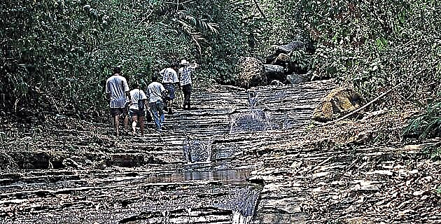
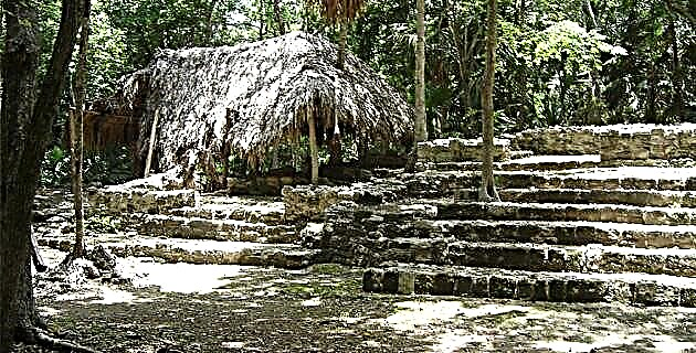
15:00. 16 kilometers to the northeast of Chetumal are the archaeological remains of Oxtankah, where we arrive by following an asphalt road that runs along the coast from the small town of Calderitas.
Unexpected mounds conceal ancient constructions hints of a dynamic past life in which Oxtankah played a prominent role.
According to specialists from the National Institute of Anthropology and History, around 800 there were important urban centers in the area; Oxtankah, along with Kohunlich, Dzibanché and Chakanbakan, was one of the main cities of the Classic period (250-900)
Its inhabitants practiced agriculture and commerce on a high scale, which determined the prosperity reflected by the imposing structures-pyramids, ball courts, temples and hydraulic works planted in a jungle area of approximately 240 km2. There is a theory that in the 10th century Oxtankah - like many Mayan cities - could suffer the consequences of the collapse that ended its splendor.
The hypothesis has also been upheld that an emigration from the state of Tabasco, from the group known as puntunes, brought a new flourishing. It is speculated that the puntuns, experienced navigators, established an intense trade based on maritime routes that reached the coast of Honduras. They also renewed the Mayan city of Chichén Itzá and maintained peace for two long centuries.
As a coastal enclave, Oxtankah is supposed to have participated in these prosperities until the power of the puntuns was disintegrated. The region was then divided into small states, hostile to each other. Oxtankah may have been the political head of Chactemal, where the myth that the Spanish castaway Gonzalo Guerrero lived there, who has been named the father of the indigenous Hispanic mestizaje in Mexico.
Among the pre-Hispanic constructions, structure IV stands out, which due to its shape and proportions seems to have been an important building for ceremonies. It is a semicircular five-section building with a side staircase, a rare feature in buildings of this class. Traces of looting and destruction suggest that its stones were used by European conquerors for works in the 16th century.
Not far to the east are the historic buildings. There are reasons to suspect that these are fragments of the town founded by the Spanish Alonso de Ávila in the middle of the pre-Hispanic city. Pieces of the wall that delimited the atrium, the central platform and the chapel complex are preserved from the church, where part of the arches that supported the vault, the walls of the baptistery and those of the sacristy can still be seen. Currently, the archaeological site has a service unit with parking, an area for the issuance of tickets, toilets and a small photographic gallery showing progress and findings of the excavations. Some trees have attached cédulas in which their properties are explained and their scientific and popular names are indicated. In such a way, the walks are fun and educational.
17:00. Already in Chetumal, a few meters from the bay, we find a museum that recreates in a small format the old village of Payo Obispo, its sandy streets, palms and wooden houses ... a recreation of nostalgia in which there is no lack of curvature in the that rainwater was stored.
The model, attractive to all tourists, has 185 wooden houses at 1:25 scale, 16 wagons, 100 flowerpots, 83 banana trees, 35 chit trees and 150 people -like the dwarfs in Gulliver's story-, and it can be viewed in four parts from a peripheral walker.
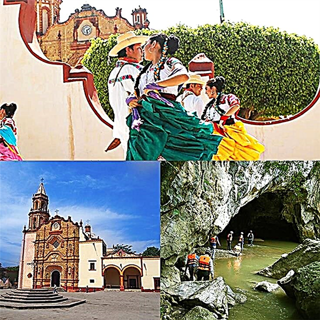
8:00 p.m. In the Plaza del Centenario, where a monument to the founder of the city stands, a dance company is presenting a regional scene that includes jaranas and pre-Hispanic recreations, under the organizational auspices of the Official Office of the Government of the State of Quintana Roo. After the event we visit part of the night jetty. On the other side of the bay you can see the lights of the first Belizean town, Punta Consejo, where an old hotel called Casablanca stands. On this side, bars and restaurants are lit up that offer Mexican and international cuisine.
SUNDAY
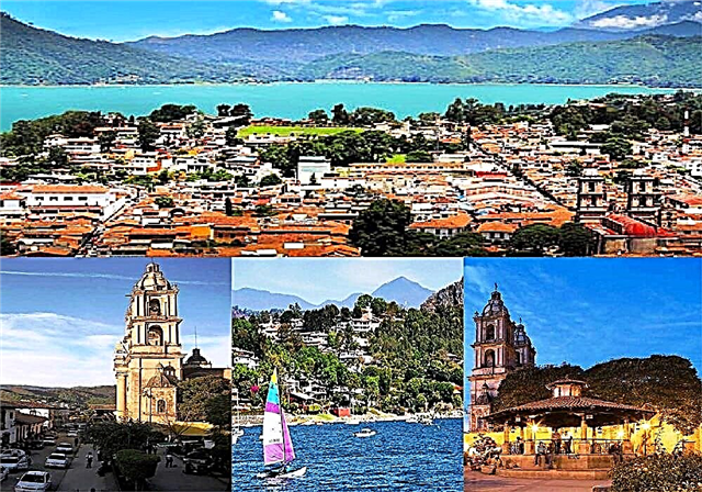
9:00. The magic of Bacalar awaits us, a town settled next to a lagoon, 37 kilometers from Chetumal on the highway that goes to Cancun. Of pre-Hispanic origin, it means in the Mayan language place of reeds, and its lagoon includes seven shades of blue that vary according to the sunlight. Children and adolescents painting, acting and dancing have been seen in the San Felipe de Bacalar fort for years. In the past, life was less romantic on these cobblestones. Like any fortress built to save its surroundings, the fort is a work born of fear. Its construction dates back to 1727, after Bacalar suffered repeated attacks by Caribbean pirates and European smugglers, mainly British.
So, field marshal Antonio Figueroa y Silva decided to revive the town, and brought in hard-working settlers from the Canary Islands. Throughout a period that extends until 1751, the town lived dedicated to agriculture until the English colonists of Belize, to the south of the Hondo River, attacked the fort. The attacks were repeated and caused shocks in the peaceful cod people, at the same time that they stimulated a life of excessive peace. It was thus that a military expedition was armed that expelled the invaders from the surrounding waters, although the conflict had its formal solution in 1783 when -by the work of a treaty signed in Paris- it was authorized that the English, former pirates turned into stick cutters of dye, remain in present-day Belize.
During the Caste War, carried out by Mayan rebels and the Yucatecan army in the 19th century, Colonel José Dolores Cetina ordered the construction of trenches and walls in the surroundings; the natives continued with skirmishes and Bacalar remained besieged by bullets.
In 1858, after a cruel battle, the survivors fled to Corozal and Bacalar was left alone. The jungle slowly took over the town and that is how it was found, at the end of 1899, by Admiral Othón Pompeyo Blanco, who had founded the village of Paya Obispo a year earlier.
The fortress remained forgotten as the 20th century flowed by. Eight decades later it was declared a monument by the National Institute of Anthropology and History. Today it is a museum where pre-Hispanic and colonial pieces are exhibited and serves as a forum for scenic and pictorial presentations.
12:00. After the encounter with history, several spas await us along the coast. Both in the Ejidal and in the Club de Velas it is possible to rent a boat and from the water contemplate the buildings that line the shore, the flowers and the evergreen trees.
This row of houses contains different architectural styles: Arab, Chinese, Swiss, British, Japanese ... Other boats cross ours and the journey continues to "the rapids", channels that fragment the lagoon, where transparency is absolute and distinguishable a beautiful underwater scenery.
The Club de Velas is an open space that has a bar, a marina and the restaurant El mulato de Bacalar, where they serve an exquisite dish, fried shrimp with olive oil, habanero pepper and garlic, as well as seafood grills. It has a magnificent viewpoint and there are catamaran and kayaks for rent.
17:00. After bathing, appetite prompts us to visit the restaurant nestled next to the Cenote Azul, whose fish come to shore to eat pieces of bread thrown by diners. The offer is abundant and exquisite, such as those dishes named Mar y selva, Camarón cenote azul and Lobster in wine.
The first is made up of venison, octopus, tepezcuintle, armadillo and breaded shrimp. The second contains shrimp 222 stuffed with cheese, wrapped in bacon and breaded; and the third is lobster cooked with white wine, garlic and butter. All delicious for the most demanding palate. We say goodbye to Chetumal. Behind it is a bay furrowed by some yellow and red sailboats that seagulls fly over. Gone is the enigma of the first Hispanic-American miscegenation. Gone is the amazement of the rain on the tiles and the just promise of a return in a magical air where the sun sets.