The San Bernardino lagoons, to the west of the Zongolica mountain range, are part of an exceptional landscape of great geological interest as it includes the presence of a volcano, in a mountainous area formed almost entirely by folds.
The San Bernardino lagoons, to the west of the Zongolica mountain range, are part of an exceptional landscape of great geological interest as it includes the presence of a volcano, in a mountainous area formed almost entirely by folds.
The INEGI map (El4B66 scale 1: 50,000) clearly shows the contour lines of the so-called Otzelotzi volcano, whose cone is distinguished from the relief of the surrounding hills and ravines.
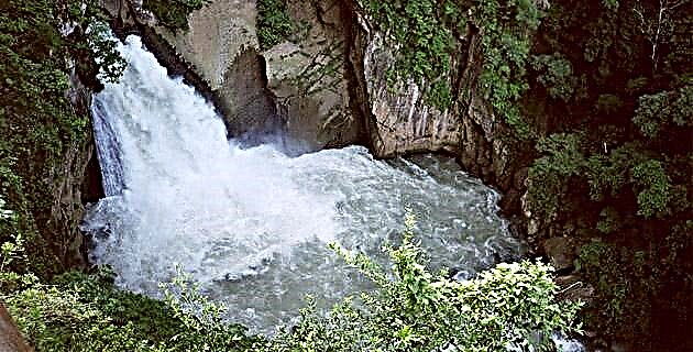
Rubén Morante had visited the site years before and had the hypothesis that the lagoons could be surrounding calderas of the main cone, which would give the volcanic apparatus an even greater interest. However, the exploration of the site led us to conclude that the lagoons were formed by the obstruction of the valleys, as a consequence of the successive lava flows from the Otzelotzi volcano.
The Otzelotzi is one of the southernmost volcanoes of the Neovolcanic Axis in the Puebla area, and coincides in parallel with the line that starts from the Cofre del Perote to the Citlaltépetl and the Atlitzin, although the latter are 45 km away. Unfortunately, there is nothing published in relation to the Otzelotzi, although the geologist Agustín Ruiz Violante, who has studied the sedimentary rocks of the region, affirms that its formation is quaternary, so that its existence may only go back several dozen thousands of years.
The altitude of the lagoons, with an average of 2,500 m asl, is similar to that of the Zempoala lagoons, in Morelos. In Mexico, only the lagoons of El Sol and La Luna, in Nevado de Toluca, significantly exceed them, since they are around 4,000 m high. One advantage of the San Bernardino lagoons over all others, particularly the Grande Lagoon, is the abundance of largemouth bass, trout and white fish that they produce.
THE VIEW
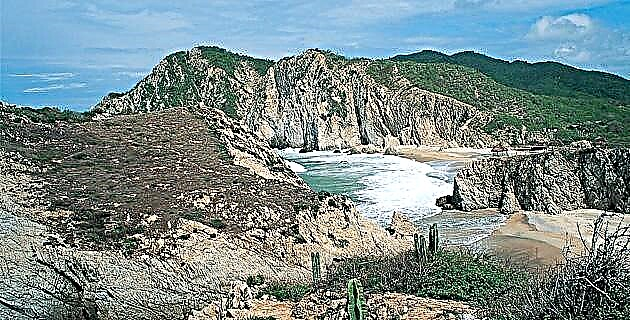
The scenery that precedes the San Bernardino lagoons is worth an excursion on its own. From the crossroads located a few kilometers from Azumbilla, on the Tehuacán-Orizaba highway, the path that crosses a wooded area with ravines up to 500 m deep begins. some hills represent dense foliage, while others show erosion by indiscriminate felling of trees. Fortunately, the Otzelotzi volcano is protected by the San Bernardino residents, who only allow minimal logging to form charcoal.
We arrived very early in the morning, when the clouds still rest on the sleeping folds of the mountains. Rubén affirms that there are legends about mermaids and apparitions, so one of our tasks is to question the oldest inhabitants of the town. Another question refers to the origin of the hill: otzyotl, in Nahuatl, means pregnancy, yotztiestar pregnant or become pregnant. It is very likely that the hill had an important meaning in relation to fertility and that women came to the place with the purpose of seeking to get pregnant. From the road that borders the Otzelotzi on the southern slopes, it is only possible to contemplate the Chica lagoon, since the Grande and the Lagunilla are found at a higher altitude in the north and east areas, respectively. The Chica lagoon rises to 2 440 m above sea level, the Grande lagoon at 2,500 and the Lagunilla at 2,600. In addition to their size, the lagoons differ in the color of their waters: the Chica lagoon brown, the Grande lagoon green and the Lagunilla blue .
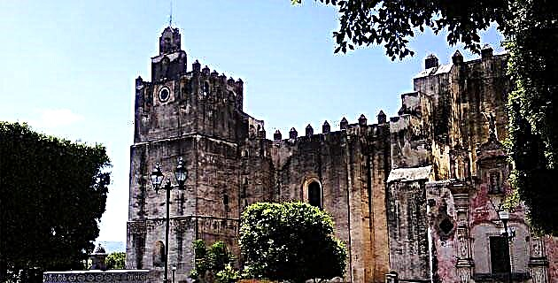
After driving in the direction of Santa María del Monte and taking some landscape photos, we return to the dirt gap that leads us, along the western slope of the Otzelotzi, to the small town of San Bernardino. By then we had already realized that the indigenous presence is scarce in this part of the sierra. Many of the inhabitants show a mixture with strong Creole features, and it is difficult to see a pure indigenous, as in Zongoliza. Perhaps migration from other places explains the ignorance of ancient stories, because of the people with whom we talked, no one knew how to give us reason about any legend.
A girl from the village contributed a very interesting fact about the mass that is celebrated on the last day of the year, at night, at the summit of Otzelotzi, at 3,080 m asl. The entire community accompanies the priest on the way up, flanked by twelve crosses. The march is impressive due to the number of candles that illuminate the 500 m gap between the town and the summit.
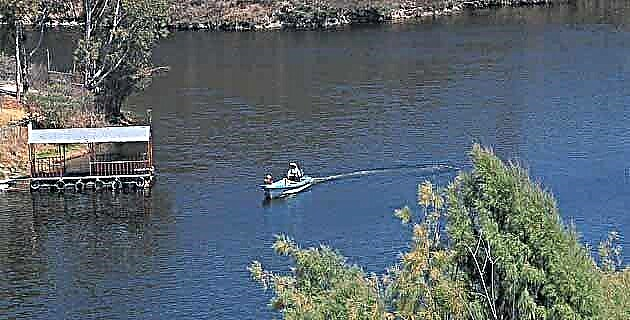
Although most of the tourists who visit the lagoons prefer to sail in the Grande Lagoon, with boats that are rented there, and eat in the restaurants on the shore, our main objective is to cover the ascent to the top, to enjoy the landscape and photograph the surrounding mountains. On clear days it is possible to contemplate, from the summit, the Popocatépetl and the Iztaccíhuatl; However, because it is cloudy towards the west, we must be content with the superb view that Pico de Orizaba gives us, located to the north.
The path is extremely pleasant due to the dense vegetation that the Otzelotzi conserves. At one point Rubén stops to photograph a worm on a pyroclastic rock that I later identified as a crystalline tuff. In the area where we ascend we do not see basalts, rocks that can be seen on the southern slope of the volcano.
The erosion of this one has deformed the crater. The base of the Otzelotzi is little more than 2 km in diameter and to the southeast it presents an elevation, the vestige of an adventitious cone. The highest area is slightly oriented towards the north of the vegetation of that slope, almost when reaching the top, it is made up of mountain thickets, as well as a large part of the eastern slope, from which Lagunilla and several distant populations. From the top to the south there is a slight slope that provides protection to a dense coniferous forest.
The best panoramic view is seen from the north: in the foreground you can see the Grande lagoon, and in the background, the Citlaltépetl and Atlitzin volcanoes. Due to the vegetation it is not possible, from the top, to distinguish towards the south, but it is comforting to know that the trees continue to be erect, superb and leafy. In addition, this vegetation provides shelter for a good number of creatures, such as the tiny chameleon that we found almost at the top and that posed for our cameras.
Finally satisfied, our hunger for scenery, we set out back down the slope. We left the boat ride on the Grande Lagoon for another time and settled for a plate of white fish and a couple of beers.
IF YOU GO TO THE SAN BERNARDINO LAGOONS
If you go from Orizaba to Tehuacán, via Cumbres de Acultzingo, you need to pass the Azumbilla cruise. Several kilometers later, on the left side, there is the deviation towards Nicolás Bravo. Between this town and Santa María del Monte is the Otzelotzi. The entire highway is paved and there is only a short stretch of dirt at the entrance to San Bernardino. The area does not have hotels or gas stations. Tehuacán, Puebla, is the closest city and is located one hour away by car.
Source: Unknown Mexico No. 233 / July 1996