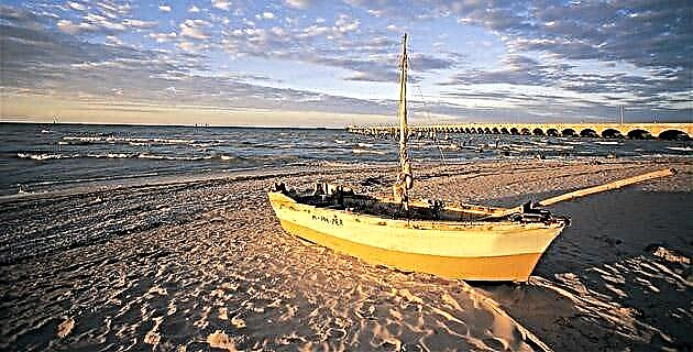
Knowing the geography of their world, the Mayans designed a sophisticated navigation system that included boats with raised bows and stern, as well as a code of natural signals and others created by them that allowed them to cover long distances safely and efficiently.
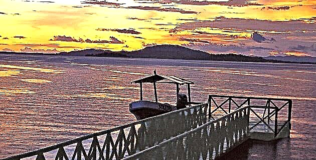
Navigation is an art-science that implies the knowledge of the water currents, the winds, the stars and the prevailing environmental conditions in the region. After navigating the Usumacinta River and going out to sea on this slope, we experience firsthand the benefits and challenges of this great art practiced by the Mayans since early times. The ancient Mayan merchant-navigators established routes that gave life to a complex network of communication and exchange, which incorporated land, river and sea routes. The section of the river that we traveled is only an experimental sample that allowed us to recognize its challenges and its contributions.
In Mayan times
Sahagún and Bernal Díaz del Castillo mention in their respective works that canoes could be bought or rented, so our assumption can be substantiated. A canoe was worth a quachtli (blanket) or a hundred cocoa beans, and as regards the rent, it is said that Jerónimo de Aguilar paid in green bills to the rowers who took him to meet with Hernan Cortes in the island of cozumel.
As for archaeological sites, Pomoná and Reforma are located in the lower Usumacinta area; It is not clear if they controlled any section of the river, but we do know, thanks to the decipherment of the inscriptions, that they were immersed in the confrontations of the political entities that competed to gain control of both territories and the products that, finally, contributed to its stability and development.
Along the path that goes from Boca del Cerro to the point where the river forks at the Palizada River, there are numerous minor archaeological sites that surely were part of the communities linked to the regional capitals that reached their peak between 600-800 AD.
The route to the Gulf
In the Relationship of the things of Yucatan, by the Spanish bishop Diego de Landa (1524-1579), it is stated that from the town of Xonutla (Jonuta) it was customary to go by canoe to the province of Yucatán, navigating the San Pedro and San Pablo rivers and from there to the Laguna de Terms, passing through different ports in the same lagoon to the town of Tixchel, from where the canoes were returned to Xonutla. This confirms not only the existence of the river-maritime route in pre-Hispanic times, but also that it was carried out in two directions, upstream and against the current.
Through the Usumacinta the Gulf of Mexico could be reached in different ways, through the mouth of the Grijalva River, through the San Pedro and San Pablo rivers, or through the Palizada river that leads to the Laguna de Terminos. Merchants who followed the route from Petén to the Gulf of Mexico along the Candelaria River were also able to arrive there.
The "Phoenicians of America"
Although it was sailed and traded since 1,000 BC, through the rivers and lagoons of the Lowlands of Tabasco and Campeche, it is not until after 900 AD, when trade by sea acquired great importance, when circumnavigating the Yucatan Peninsula , which was controlled by Chontal affiliation groups, known as Putunes or Itzáes.
The Chontal region extended from the Cupilco River, near Comalcalco, towards the coast in the deltas of the Grijalva, San Pedro and San Pablo rivers, the Candelaria river basin, the Laguna de Terminos, and probably as far as Potonchán, a town located in the coast of Campeche. Towards the interior, through the lower Usumacinta, it reached Tenosique and the foothills of the sierra. According to the American archaeologist Edward Thompson (1857-1935), the Itza came to dominate the basins of the Chixoy and Cancuén rivers, in addition to having commercial enclaves in the port of Naco in the vicinity of the Chalmalecón river, in Honduras and the port of Nito , in the Golfo Dulce.
The geographical characteristics of the region inhabited by the Chontales, favored the fact that they became experienced navigators and that they took advantage of the river systems that allowed communication with places beyond their borders; later they conquered territories and producing regions and imposed taxes, thus they could exercise control over the long distance trade route. They established an extensive network of ports located at strategic points along the route and also developed an entire maritime navigation system, this implied several advances such as: the manufacture of more suitable vessels; signs along the routes to get the path right (from the tree marks mentioned by Fray Diego de Landa, to masonry structures); the creation and use of directions, even on canvas (like the one given to Hernán Cortés); as well as the use of a code of signals emitted both by the movement of flags or fires as a signal.
Throughout the development of this culture, trade routes by waterways were modified, as did the interests and actors that controlled them; being those of greater distance, those carried out during the Classic by the vast Grijalva-Usumacinta fluvial system and for the Postclassic period, those bordering the peninsula, which started from sites on the Gulf coast and reached Honduras.
In the region that we traveled, we found several ports:
• Potonchán in the Grijalva delta, which allowed communication with ports located both north and south.
• Although there is no reliable evidence of the existence of one of the most important, it is believed that Xicalango, in the peninsula of the same name, traders came from central Mexico, Yucatan and Honduras through different routes.
• There were also important ports of Chontal affiliation: Tixchel in the Sabancuy estuary, and Itzamkanac in the Candelaria river basin, which corresponds to the archaeological site of El Tigre. Traders left from all of them to various parts of Mesoamerica.
• For the Campeche coast, the sources mention Champotón as a town with 8,000 masonry houses and that daily about 2,000 canoes went out to fish that returned at dusk, which is why it must have constituted a port city, although its peak occurred on that date. later than the ports mentioned.
Control from above
Those whose are elevations of the land made by man, without architectural elements, which reach great heights and are located on the banks of the river, in strategic positions. Among the most important ones are those of the towns of Zapata and Jonuta, since from there a good part of the river is dominated.
Ceramics, a valuable commodity
The Jonuta region was in the second half of the Classic and early Postclassic periods (600-1200 AD), a producer of fine-paste pottery, widely commercialized, both along the Usumacinta and in the Campeche Coast. Their pottery has been found in places like Uaymil and the island of Jaina in Campeche, important places on the long-distance maritime trade route that the Mayans made and that we hope to visit on our next trip.