A few days ago I took a tour of this region, which has excellent natural areas that have begun to be discovered thanks to ecotourism. This trip allowed us to know the Guanajuato Bajío by water, land and air.
From the heights
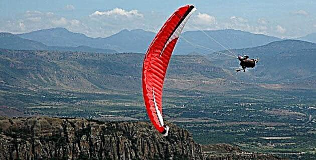
Our adventure began in the famous Cerro del Cubilete, in the municipality of Silao, whose summit, located 2,500 meters high, is crowned by the monument to Christ the King. The place is excellent for practicing paragliding free flight, a technique that allows you to take advantage of the rising air currents to glide for long distances. With no more time to lose, we prepare all the equipment to take flight and enjoy the wonderful view of the Guanajuato Bajío. This was our first image of the territory that we would later explore by land.
Around the wheel
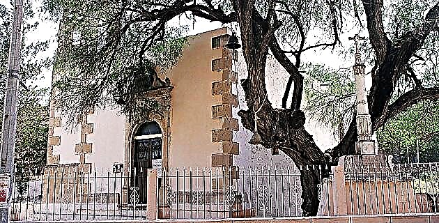
Once we landed, we moved to the city of Guanajuato to prepare our next adventure, now on wheels. We put together our mountain bikes to travel the Old Camino Real. We started the road until we reached the town of Santa Rosa de Lima. There, we stopped for a moment to witness the town festival that took place that day, commemorating the taking of the Alhóndiga de Granaditas, in 1810, by the insurgent forces under the command of priest Hidalgo. Once the representation of the combat between insurgents and Spaniards ended, we looked for a little place to have a drink, only that on the way we found an excellent typical sweet shop, run and managed by the women of the Sierra de Santa Rosa. So, after the kind attention and multiple “tastes”, we had no choice but to leave with a vast shipment of sweets and preserves.
We resumed pedaling following the Camino Real –that linked the towns of Guanajuato and Dolores Hidalgo- to enter the fantastic Sierra de Santa Rosa (with about 113 thousand hectares of oak and strawberry tree forests, mainly) towards the town of Dolores Hidalgo , which is part of the Magic Towns program due to its great historical and cultural wealth. Finally, with sore legs but happy to have completed this tour, we stopped to rest a bit and try one of the delicious ice creams that had been recommended to us in Santa Rosa when they found out that we would get here by bicycle.
To the depths
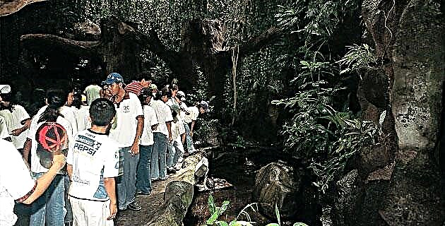
Our last adventure through the Guanajuato Bajío was in the Murcielagos Canyon, located 45 kilometers from the city of Irapuato, in the Pénjamo mountain range, Cuerámaro municipality. The name of the canyon is due to the fact that, at the top, a cave is located where every day, around eight o'clock at night, thousands of guano bats come out to eat that draw a large horizontal column in the sky. A show worth witnessing.
We left Irapuato to a place known as La Garita. There we detour until we reach a parking area where we prepare all our equipment to now practice canyoneering. Our objective was to complete the entire crossing of the Murcielagos Canyon. An expert tour that took us nine hours to complete, although we saw that there are also shorter tours, of two or four hours, for beginners.
Our hike began by following the path that borders this spectacular canyon. We walked for two hours and crossed three different ecosystems: the low deciduous forest, an oak forest and the humid forest, where we took the opportunity to cool off in the springs. The trail led us through thick vegetation and an area of fruit trees, until we reached the bottom of the canyon. We equipped ourselves with helmets, wetsuits, harnesses, carabiners, descenders and life jackets, and we began to jump between the rocks, until we reached the section known as La Encanijada, from where we descended seven meters in rappel through a strong jet of Water. From there we continue until we reach the section known as Piedra Lijada, one of the most beautiful in the canyon where the water has polished the rocky floor until it is reddish and ocher.
Later, following the course of the canyon, we reached an area where we could rappel down two huge waterfalls, one of them measuring 14 meters known as La Taza. The second, 22 meters long, took us to the Poza de las Golondrinas where we all dove to relax a bit.
To finish, we reached the Devil's Pool, one of the places that most impacted us, because while the canyon was narrowing until it was only seven meters wide, the rock walls rose between 60 and 80 meters above our head. Something really spectacular. After traversing that section and nine hours of hiking, we finally left the canyon. Even with adrenaline running high, we began to take off our equipment while talking about the incredible experience of having traveled “up and down” the Guanajuato Bajío.
Photographer specialized in adventure sports. He has worked for MD for over 10 years!