Enjoy the magnificent and beautiful beaches of "Perla Tapatia": places that, if we pay a little more attention, will make your trip a unique experience.
When we travel from the beautiful "Perla Tapatia" to the tourist and paradisiacal Puerto Vallarta, we very intensely want to arrive promptly at our destination to enjoy its magnificent and beautiful beaches, which is why we take the shortest route and do as few as possible of stops. Making our trip in this way we can complete it in about four or five hours, driving at good speed, although this causes us to overlook countless interesting places that exist along this journey, places that, if we lend them a little more of attention, they will make the tour much more entertaining.
Our adventure begins when we leave the city of Guadalajara and take federal highway 15, passing the towns of La Venta and La Cruz del Astillero, to run into El Arenal a little further on, a small town of 7,500 inhabitants called “Un Pueblo de Amigos ”. At the first railroad crossing that we passed when leaving El Arenal, we made the first stop because here the traditional "guajes" (from Nahuatlhuaxin, generic name of various fruits that are used to make pots) are offered to the traveler, in different sizes and forms, which can serve either as decorative elements or as vessels (canteens, tortilla holders, etc.). In this same place we can find different crafts made in obsidian and the sale of opals.
About 10 km ahead of El Arenal we pass through the city of Amatitán (which etymologically means "place where amateurs abound"), whose population, of just 6,777 inhabitants, is proud of its history, which states that it was here where it was elaborated for the first time the famous tequila, although this idea is not entirely proven.
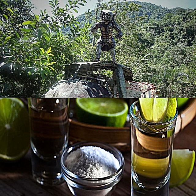
Following our route we arrive, now, to what is considered the "Tequila Capital of the World", we refer to the city of Tequila, Jalisco, with a population of 17 609 inhabitants, distinguished by this popular drink and the abundant outlets in the that we can find it in its various presentations and brands. Furthermore, we can say that from El Arenal to Magdalena (next city on our itinerary), the landscape is painted blue, since most of the fields near the road are planted with the famous tequila blue agave, thousands of liters of tequila in power, adjust!
Already well stocked with several bottles of this drink (in the trunk of the car, it is not our stomach), we continue the road to Magdalena, Jalisco. During this part of the route, our attention is drawn to the brightness reflected by the rocks that flank the road and which are nothing but obsidian (volcanic glass, generally black), a material that makes up these rock formations. Thus, contemplating this natural wonder, we arrive at the city of Magdalena (about 2 km before we find the junction with the new Maxipista, which we will take after having visited this picturesque town).
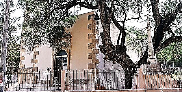
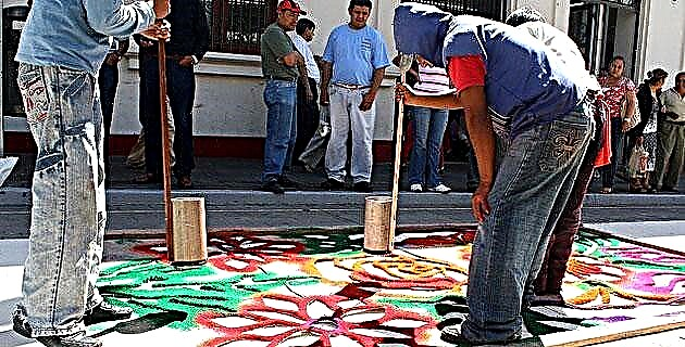
Magdalena is a municipality famous for its abundant and prosperous mines of semi-precious stones (highlighting the production of opals, turquoise and agates), so it is very common to find a large number of stores that offer these gems in various presentations. In addition to buying opals (considered unlucky by some), we must visit the Temple of the Lord of Miracles which has a beautifully covered dome with yellow tile, as well as the small Chapel of the Purísima, a temple founded in the XVI century that today it is invaded by annoying street commerce. In the main square, a picturesque kiosk stands out from which there is a very peculiar view of the Temple of the Lord of Miracles.
In this town there is also an office of the National Indigenous Institute (INI), which serves as a link with the Cora and Huicholas communities of the rugged Jalisco mountain range. If after having made our tour of the city we feel a little appetite, we can delight ourselves with a succulent toast, but be careful, they are not normal toasts, because they can reach up to 25 cm in diameter, so it is worth thinking twice before ordering more than one of the “little” Magdalenian toasts.
After this we return to Guadalajara (only two km) to take the new Maxipista (Magdalena, Jalisco-Ixtlán del Río, Nayarit section), which is an excellent option if we do not want to go through the winding and dangerous Plan de Barrancas road . This Maxipista is in excellent condition and is very safe, since every 3.5 km (approximately) there are first-aid stations with water and radio signals to call for help if required. This new road ends (for the moment) at the exit of Ixtlán del Río, Nayarit (although it should be mentioned that this mouth is a bit dangerous due to very steep curves and scarce signage). Before taking road no. 15 It is convenient to enter Ixtlán del Río to see the interesting archaeological zone and some other relevant sites in the city.
This archaeological zone (also known as “Los Toriles”) is located 3 km east of Ixtlán del Río, on the right bank of the highway. It is made up of several sets of structures, all of them low in height but of a very peculiar style. This site has been dated to AD 900-1250. (Postclassic period). The main center is made up of a square with an altar and, on the sides, two rectangular-shaped buildings. One of these buildings has a road made of stone slabs that leads to the Circular Pyramid, which (due to its shape and finishes) is considered one of the most beautiful buildings of pre-Hispanic architecture in western Mexico.
Throughout the entire site we can see, scattered on the ground, innumerable fragments of ceramic and obsidian, which gives us an idea of the cultural richness of the area. The total extension of the pre-Hispanic occupation is 50 hectares, of which only eight remain protected by cyclonic mesh and are guarded by delinah personnel. When you visit this place remember that it also belongs to you: please do not destroy it!
Once we have marveled at the greatness of our ancestors, we return to Ixtlán to take a look at the Temple of Santiago Apóstol, in whose atrium there is a quarry cross dating from the seventeenth century. Here in Ixtlán del Río there is a small airport where we can board a plane that will take us to the Cora and Huicholas de la Sierra communities, especially if we like strong emotions.
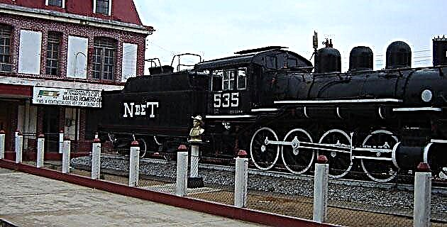
A few kilometers ahead of Ixtlán del Río a small town called Mexpan is located, in which a great variety of wooden furniture is manufactured, as well as baskets and some other handicrafts made of stick and palm. Passing Mexpan (12 km from Ixtlán) the next stop is Ahuacatlán, Nayarit, where it is convenient to visit the temples of Nuestra Señora del Rosario and San Francisco, the latter established in the 16th century and currently closed to worship. Here it is also worth going to the attractive railway station (Guadalajara-Nogales), which seems to emerge from the vegetation and inevitably takes us back to the times of the railway boom in our country.
After a brief tour of the station, we resumed the path once more only to marvel, once again, at the astonishing spectacle of the volcanic material deposited on both sides of the road. All this material corresponds to one of the last eruptions of the Ceboruco volcano, located southwest of the San Pedro mountain range, and whose last eruption occurred in the year 1879. (If you wish, you can visit the top of the volcano, taking the dirt road that goes from the town of Jala to the highest part of the cone).
Resuming our tour we arrive at Santa Isabel, a small town that offers us, in addition to beautiful pieces of pottery, the exquisite and refreshing cane juice (very cold) which, if we mix it with lemon juice, will quickly quench our thirst. In this same place we can buy fresh bee honey as well as a rustic and traditional molcajete for the preparation of a rich and spicy sauce.
Having recharged our batteries with this cold drink, we arrived in Chapalilla in a short time, at which point we will abandon our familiar federal highway no. 15 to enter the toll road corresponding to Highway 200, on which we will pass through San Pedro Lagunillas and, later, through Las Varas, from where we begin to observe the characteristic vegetation of tropical areas.
A few kilometers from Las Varas you can take the detour that leads to Chacala (a beautiful beach with fine sand), or continue to Peñita de Jaltemba to stop to enjoy a slice of fresh fruit or buy one or more bags of the same, all at very cheap prices. Immediately we must enter Rincón de Guayabitos, a quiet beach with all tourist services where we can sit on the seashore to enjoy a beautiful show, accompanied by a delicious "crazy coconut".
Almost at the end of our journey, we passed by countless places that have beautiful beaches of fine sand, such as Lo de Barco, Punta Sayulita and Bucerías to finally cross the bridge over the Ameca River, which some consider "the longest in the world ”, since as it divides the states of Nayarit and Jalisco, due to the time change, crossing it takes (hypothetically) an hour.
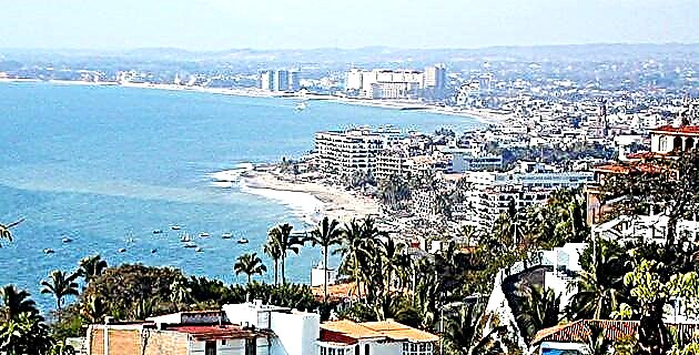
So we finally arrive at the fabulous and very crowded Puerto Vallarta, where we will rest from our busy trip sitting on one of the benches of the traditional boardwalk, watching a majestic sunset.
As we could realize, the road from Guadalajara to Puerto Vallarta offers us a lot of pleasant surprises that will surely make our next trip to this port more pleasant and will undoubtedly increase the amount of memories that we will take back. to our home. Happy journey!
Source: Unknown Mexico No. 231 / May 1996