Nayarit is a state with exuberant and beautiful natural resources, with warm and shallow water beaches where everything is life, abundance and rest. Territory of remote traditions and expression of atavistic cultures: In this land of Nayar where the sun comes to rest every afternoon, there will always be cities and towns to discover.
In addition to Bahía de Banderas, which belongs to the club of the 30 most beautiful bays in the world, Nayarit is a tourist atlas that always has something to reveal, as many parties as there are towns, archaeological sites; challenging peaks of a long mountain range and splendid valleys through which crystalline torrents descend towards the ocean.
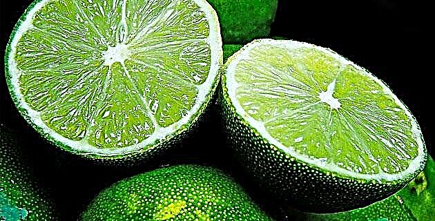
At the side of many roads there are stout huanacaxtles, leafy acacias and cabins scattered among banana trees, guava trees; papayas and avocados, old trees grown in the orchards that perfume the environment with aromas of fresh fruit.
The coastal plain is a strip of low soils limited by marshes, mats, mangroves; by the beaches and the mouths that form the Acaponeta, San Pedro Tenenehpa, Santiago Lerma, Huitzitzila rivers.
Throughout the state there are areas of great natural beauty, such as Boca de Camichín, where the waters of the ebb and flow of the sea make Mexcaltitán emerge, a small island that emerges between mats and rivers on the Nayarit coast from where it is believed the Aztecs started. Colorado, Sestea and Novillero, with its infinite 80 km beach, are ideal places to enjoy the tranquility and beauty of the sea.
On the mats of Teacapán, Tortuguero and Naranjo, the branches of the mangroves form a canopy and intertwine the banks. San BIas for its part, separates the coastal plain and the bays, from erect palm trees and wild vegetation; This region, by the way, is a paradise for bird watching, with more than 300 tropical, aquatic and migratory species. In addition, it is today considered one of the Nayarit tourist destinations that still maintain its ecological environment.
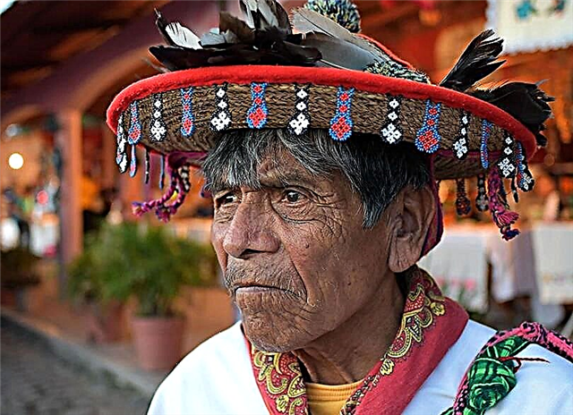
Impenetrable for many years, to the Sierra Madre Occidental, which breaks and twists into countless cliffs, ravines and successive peaks; It is only defeated by the indigenous villages that link minimal settlements. In the almost inaccessible mountain, the Coras, the Huichols, the Tepehuanes and the Mexicaneros, of ancient customs, traditions and religious beliefs take refuge.
In the Neovolcanic Axis, stepped plains are located at the foot of the Sangangüey, San Juan Xalisco, San Pedro Lagunillas and Ceboruco volcanoes, and most of the sugarcane populations are distributed in them, such as Atonalisco, Pochotitán, Puga, San Luis de Lazada, Compostela, Santa María del Oro, Ahuacatlán, Ixtlán and Rosario, where the Ceboruco volcano produced a beautiful natural scene: the work of Garabatos or El Manto, where it falls into a beautiful waterfall and the hot springs of Amatlán de Cañadas flow.
In the craters, the sunlight makes the Tepetiltic, Sapta María del Oro, San Pedro Lagunillas and Encantada de Santa Teresa lagoons mirror, as well as the huge Aguamilpa dam, framed in the Matatipac valley.
In the Sierra Madre del Sur, parallel to the coastal highway 200, there are the still unknown small bays and beaches of Jolotemba, Custodio, Tortuguero, Las Cuevas, Naranjo or Agua Azul and Litibú, with a solitary and mysterious appearance.
The mountain range has extraordinary canyons, ravines and gullies that rush into the Cara and El Salto de Jumatán waterfalls, a 120-meter high waterfall that is used to generate electricity.
Nayarit has a special charm of color, tradition, flavor and adventures that the locals enjoy; but it is always available to visitors.
Source: Unknown Mexico Guide No. 65 Nayarit / December 2000