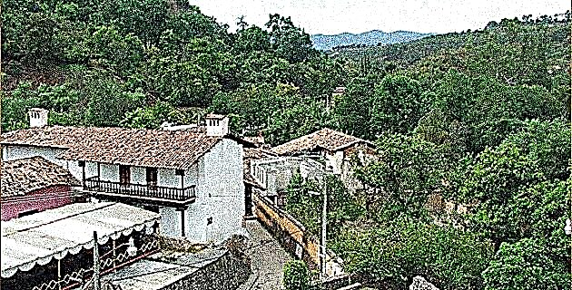
Alto Amajac is located in part of the municipality of Atotonilco el Grande, whose head, with a similar name, rests on a long plateau flanked on both sides by two ravines: the Rio Grande de Tulancingo and the Amajac.
Hidalgo is a state of contrasts. When traveling from one place to another we observe in these lands a great variety of landscapes, climates and vegetation, enriched by streams, springs and rivers. This entity, despite being in the center of the country, the most inhabited region and with the best means of communication, still preserves hidden places, little known, which are located very close to cities and other places with a large influx of the public: the National Parks.
Between the upright cliffs of El Chico National Park, in the middle of the pine forests and the moss that covers them, a stream begins to run. It is joined by minor tributaries at the bottom of ravines, clearly observable from the top of the Escondida rock, located 140 m above the Los Cedros stream, known in this area. Its waters fall through the beautiful Bandola waterfall, near the intersection of a paved road that connects the federal highway via short to Tampico with the towns of Carboneras and Mineral del Chico. Later the current takes the course of the north, now the Bandola river, which begins in a ravine that later will be a canyon, but before entering the hollow it receives its real name: Amajac.
Alto Amajac is located in part of the municipality of Atotonilco el Grande, whose head, with a similar name, rests on a long plateau flanked on both sides by two ravines: the Rio Grande de Tulancingo and the Amajac. The plateau is made up of igneous rocks from the Tertiary era, generally composed of basalt, a fine-grained rock that can be permeable and impermeable to water from precipitation. Permeable soils exist in the north of the Atotonilco Plateau, where the El Zoquital farm is located. Although impervious basalts with clay slate capable also appear, permeable soils are a real problem for farmers in El Zoquital when they need to store water in dams to irrigate their plantations.
Many years ago, the owners of this farm built a dam, but after the rains and despite the existence of a feeder channel, the soil absorbed the water without leaving any drop in the reservoir. Currently there are cultivated land with ditches and canals, although most of the land dedicated to that use is temporary. Hernán Cortés, in his Letters of Relationship, recorded an event that according to scholars occurred in the plains of the Atotonilco Plateau.
In 1522, the Otomi of Meztitlán, after having peacefully agreed to pay tribute to the Spaniards, “not only ceased to render the obedience that they had previously offered, but even did much damage to the region's land, who were vassals of your Catholic Majesty , burning many towns and killing many people ... "
Cortés sent a captain with "thirty horsemen and one hundred pawns, crossbowmen and gunmen ...", but the situation did not reach more than a few casualties, as Cortés points out: "And it pleased Our Lord that they of their will returned in peace and the Lords brought me, whom I forgave for having come without having arrested them ”.
THE HACIENDAS OF ATOTONILCO
The Atotonilco area enjoys a temperate subhumid climate with average annual temperatures ranging between 14 and 16 ° C, and with rainfall varying from 700 to 800 mm throughout the year. The region has been inhabited by people of Otomí descent since pre-Hispanic times, although today many of the cultural features of this ethnic group have disappeared. The name Atotonilco is a composition of three Nahua words that give it the meaning of "place of hot water", most likely related to the hot springs that exist in the vicinity of the town.
The Otomi were dominated by the Chichimecas in the early twentieth century, not before invading the Valley of Mexico thanks to the decline of Tula. After four centuries, it is the Chichimecas who succumb to the Mexica under the command of Moctezuma Ilhuicamina, resulting in the imposition of an uncomfortable tribute that the vassals sent to Tenochtitlan. At the conclusion of the Spanish conquest, the natives are freed from their old tribute, but when Hernán Cortés hands over the town of Atotonilco to his cousin Pedro de Paz, they are once again obliged to contribute grain and food to their new authorities.
When Pedro de Paz died, custody passed to the power of Francisca Ferrer; then it belonged to Pedro Gómez de Cáceres, who gave it to his son Andrés de Tapia y Ferrer. The latter founded the Hacienda de San Nicolás Amajac, today divided into two parts known as San José and EL Zoquital. Tapia y Ferrer receives some grants granted by Viceroy Diego Fernández de Córdoba, in such a way that in 1615 he was the owner of 3,511 hectares that were used for livestock; it is said that he accumulated more than 10 thousand, among other minor properties.
Between 1615 and 1620, Tapia y Ferrer sold a large part of their possessions to Francisco Cortés, who became the most important landowner in the region, by buying more land from Miguel Castañeda, reaching almost 26 thousand hectares. The San Nicolás Amajac hacienda passed from hand to hand until at the beginning of the 19th century, its then owner, Mrs. María de la Luz Padilla y Cervantes decided to divide the 43 thousand hectares of surface into two to create two farms, one called San Nicolás Zoquital , and another San José Zoquital. In our days the first is known as El Zoquital and the second as San José.
The socio-political and economic situation that reigned during the years prior to the government of Porfirio Díaz gave very different destinies to each of the two estates. EL Zoquital falls into total bankruptcy and passes into the hands of the government; On the other hand, San José retains its splendor until the time of the agrarian distribution, after the revolution, when its land was sold on credit and at an affordable price. Then, the peasants of the neighboring towns bought these goods. Now, these lands are ranches dedicated to agribusiness, while a walnut and pine nut processor operates on the former farm of El Zoquital.
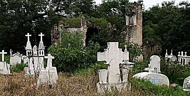
THE CONVENTUAL COMPLEX OF SAN AGUSTÍN
The first Augustinian friars to arrive at Atotonilco el Grande in 1536 were Alonso de Borja, Gregorio de Salazar and Juan de San Martín. The three religious took care of studying the language of the natives in order to communicate with them and be able to instruct them in the new religion. Alonso de Borja died shortly after reaching Atotonilco, and the Augustinian who preached in Metztitlán, Fray Juan de Sevilla, takes his place. He began the construction of the great nave of the temple with its vault and had the Plateresque portal carved in quarry, where he left the figure that represents the origin of the name of Atotonilco; a pot over fire emanating steam.
In this first construction period, which occurred between 1540 and 1550, the upper and lower floors of the convent were also built, on whose walls murals with religious and philosophical themes were painted, such as the one that exists in the stairwell, where the image of Saint Augustine appears surrounded by the philosophers Aristotle, Plato, Socrates, Cicero, Pythagoras and Seneca. Unfortunately some paintings already show a serious degree of deterioration. The second stage of construction concludes in 1586, date that appears inscribed in the vault of the choir. Fray Juan Pérez is then in charge of the completion of the rest of the church, currently located on one side of the main square.
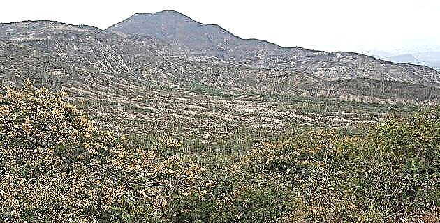
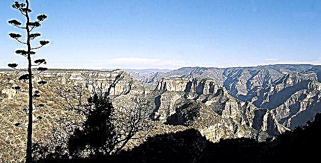
The Atotonilco Plateau is the prelude to a region of mountain panoramas, where changes in altitude and vegetation are already felt after passing through the vicinity of Mineral del Monte. From pines and oaks we go to mezauites, huizaches and cacti in a stretch of only 30 or 40 kilometers.
From the 2,080 m of altitude of the mesa where Atotonilco is settled, the water currents cross the interior of the earth to later appear in springs of sulphurous waters, in semi-arid ravines, those that towards the west end in the Amajac river, at 1 700, 1 500, 1 300 m altitude, lower and lower. There, where the mountains decide to join to form natural bridges and perforated by rivers; where the heat overwhelms and the greenery before the rains, refreshes.
IF YOU GO TO ATOTONILCO THE GREAT
Take road no. 130 to Pachuca. Passing this city 34 km away is the town of Atotonilco.
To the San José farm: it is reached by highway no. 105 heading towards Huejutla, seven kilometers ahead, turn right onto the dirt road to the town of San José Zoquital, where the farm is located. Visiting it is not easy, as it is currently inhabited.
Exhacienda de El Zoquital: In the same way, take the direction of Huejutla and 10 km ahead, take a left along the dirt road to reach the town of El Zoquital, where the Hacienda San Nicolás Zoquital is located.